MyTopo
New Ellenton SW South Carolina US Topo Map
Couldn't load pickup availability
Also explore the New Ellenton SW Forest Service Topo of this same quad for updated USFS data
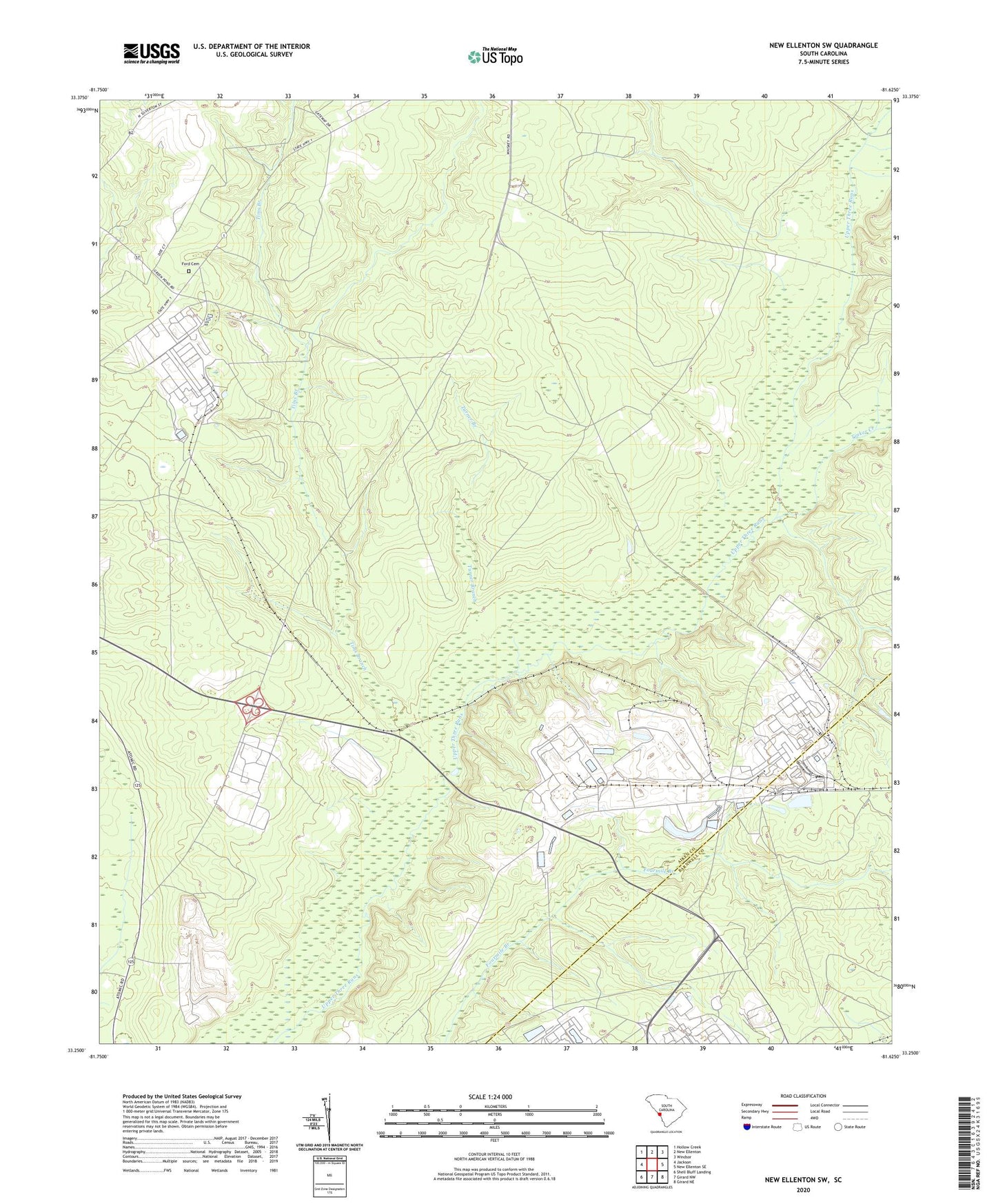
2024 topographic map quadrangle New Ellenton SW in the state of South Carolina. Scale: 1:24000. Based on the newly updated USGS 7.5' US Topo map series, this map is in the following counties: Aiken, Barnwell. The map contains contour data, water features, and other items you are used to seeing on USGS maps, but also has updated roads and other features. This is the next generation of topographic maps. Printed on high-quality waterproof paper with UV fade-resistant inks.
Quads adjacent to this one:
West: Jackson
Northwest: Hollow Creek
North: New Ellenton
Northeast: Windsor
East: New Ellenton SE
Southeast: Girard NE
South: Girard NW
Southwest: Shell Bluff Landing
This map covers the same area as the classic USGS quad with code o33081c6.
Contains the following named places: Bear Pond Church, Bloomsdale School, Brinkley Academy School, Ford Cemetery, Green Pond Baptist Church, Greendale School, Hawthorne, Hawthorne School, Jackson Division, Saint Johns Church, Savannah River Ecology Laboratory, Savannah River Forest Station, Savannah River Laboratory, Savannah River Plant Heliport, Savannah River Plant Pond Number 25-288-F D-3156 Dam, Substation Number 2, Tims Branch, Tinker Creek, Treadway Church, Turner Branch, Union Branch Church, Union Branch School, Zion Fair Church