MyTopo
Jewell Georgia US Topo Map
Couldn't load pickup availability
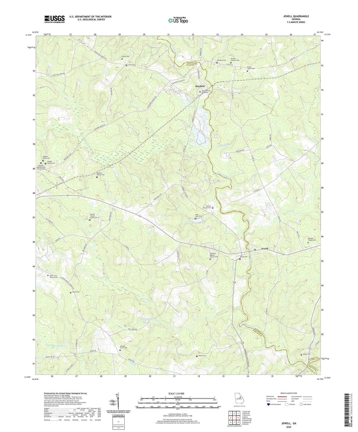
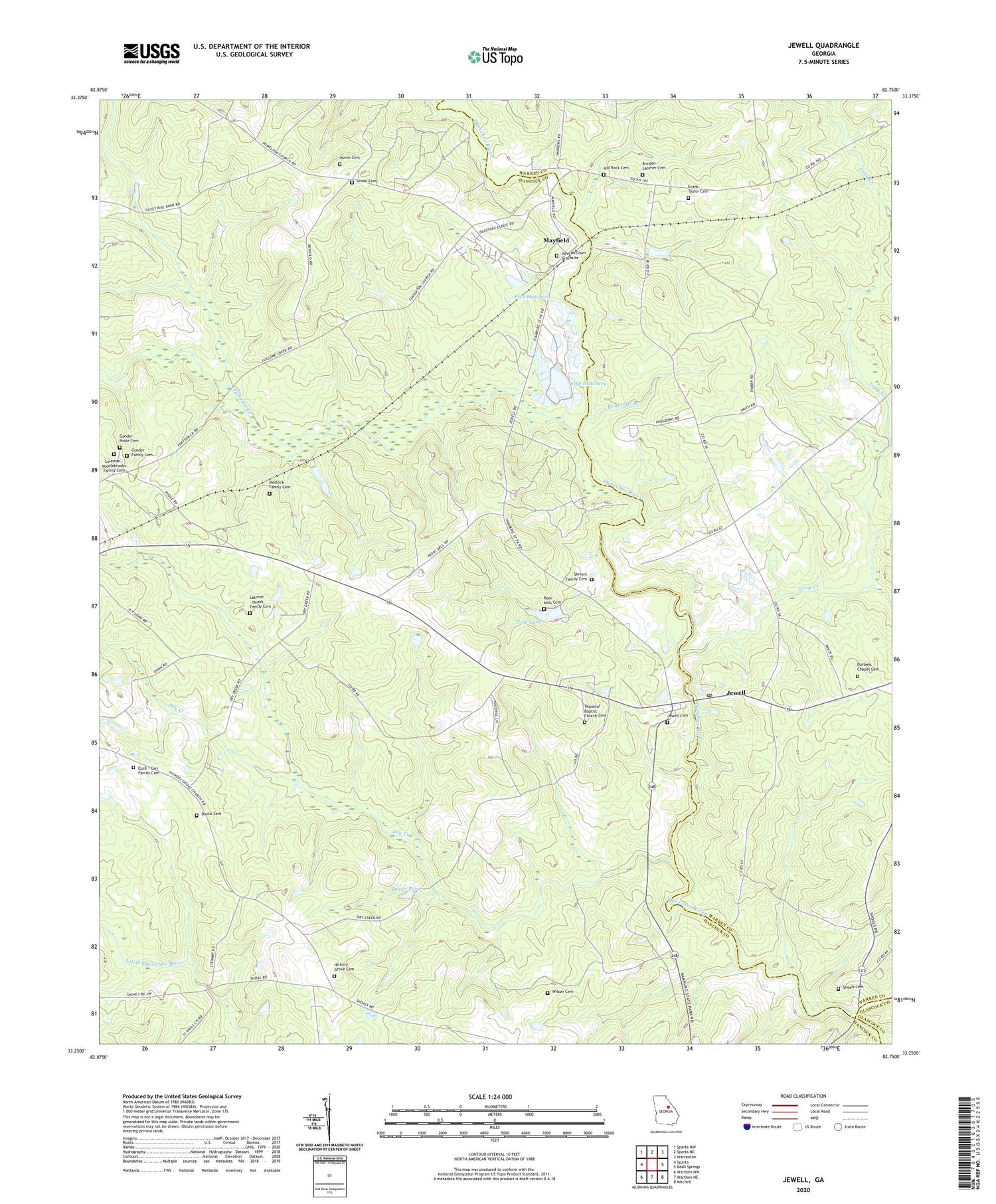
2024 topographic map quadrangle Jewell in the state of Georgia. Scale: 1:24000. Based on the newly updated USGS 7.5' US Topo map series, this map is in the following counties: Hancock, Warren, Glascock. The map contains contour data, water features, and other items you are used to seeing on USGS maps, but also has updated roads and other features. This is the next generation of topographic maps. Printed on high-quality waterproof paper with UV fade-resistant inks.
Quads adjacent to this one:
West: Sparta
Northwest: Sparta NW
North: Sparta NE
Northeast: Warrenton
East: Beall Springs
Southeast: Mitchell
South: Warthen NE
Southwest: Warthen NW
This map covers the same area as the classic USGS quad with code o33082c7.
Contains the following named places: Ansley, Brinson - Latimer Cemetery, Coleman - Middlebrooks Family Cemetery, Dixon Pond, Dry Creek, Dunns Cemetery, Durbeys Chapel Cemetery, Evans - Taylor Cemetery, Ezell - Carr Family Cemetery, Fish Hatchery, Fish Hatchery Dam, Fulsome Creek, Gonder Family Cemetery, Gonder-Poole Cemetery, Hale Lake, Hale Lake Dam, Hickory Grove Cemetery, Hickory Grove Church, Horeb Cemetery, Horeb Church, Jewel Historic District, Jewell, Jewell Baptist Church, Jewell Cemetery, Jewell Post Office, John McCown Gravesite, Latimer - Heath Family Cemetery, Long Creek, Martin Tabernacle Church, Mayfield, Mayfield Division, Medlock Family Cemetery, Mill Rock Cemetery, Millrock Church, Reynolds Branch, Rock Mills Cemetery, Rock Mills Methodist Church, Shivers Family Cemetery, Shoals, Shoals Cemetery, Shoals Primitive Baptist Church, Short Creek, Stevens Mill, Thankful Baptist Church Cemetery, Thankful Church, Thankful School, Trinity Church, Union Cemetery, Union Church, Union School, Wilson Cemetery, ZIP Code: 31045