MyTopo
Yatesville Georgia US Topo Map
Couldn't load pickup availability
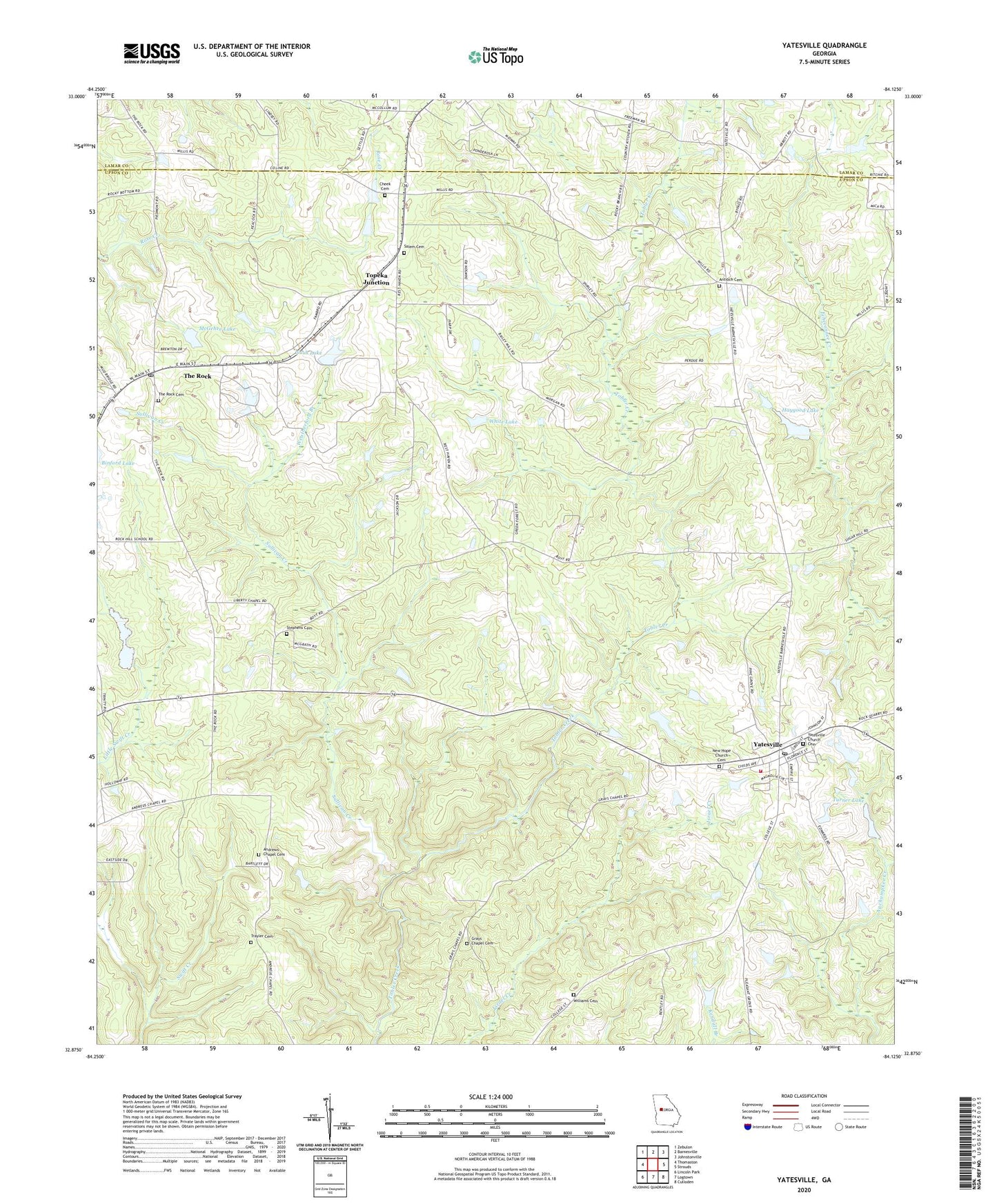
2024 topographic map quadrangle Yatesville in the state of Georgia. Scale: 1:24000. Based on the newly updated USGS 7.5' US Topo map series, this map is in the following counties: Upson, Lamar. The map contains contour data, water features, and other items you are used to seeing on USGS maps, but also has updated roads and other features. This is the next generation of topographic maps. Printed on high-quality waterproof paper with UV fade-resistant inks.
Quads adjacent to this one:
West: Thomaston
Northwest: Zebulon
North: Barnesville
Northeast: Johnstonville
East: Strouds
Southeast: Culloden
South: Logtown
Southwest: Lincoln Park
This map covers the same area as the classic USGS quad with code o32084h2.
Contains the following named places: Andrews Chapel, Andrews Chapel Cemetery, Antioch Cemetery, Antioch Church, Bethlehem Temple, Cheek Cemetery, Grays Chapel, Grays Chapel Cemetery, Grays School, Haygood Dam, Haygood Lake, Liberty Chapel, Liberty School, McGehee Lake, McGehee Lake Dam, Middlebrooks, Mount Olive Church, Mount Zion Baptist Cemetery, Mount Zion Church, Nash Dam, Nash Lake, New Hope Church, New Hope Church Cemetery, Pine Grove Church, Rest Haven, Saint Timothy Church, Salem Cemetery, Spring Hill Church, Stephens Cemetery, Sullivan Creek, The Rock, The Rock Cemetery, The Rock Census Designated Place, The Rock Post Office, The Rock United Methodist Church, The Rock-Yatesville Division, Thistle Field, Topeka Junction, Town of Yatesville, Trayler Cemetery, Turner Dam, Turner Lake, Union Hill School, Upson Camp Ground, Weatherford Branch, White Dam, White Lake, Williams Cemetery, Yatesville, Yatesville Church Cemetery, Yatesville Fire Department, Yatesville Methodist Church, Yatesville Post Office, ZIP Code: 31097