MyTopo
Tarboro Georgia US Topo Map
Couldn't load pickup availability
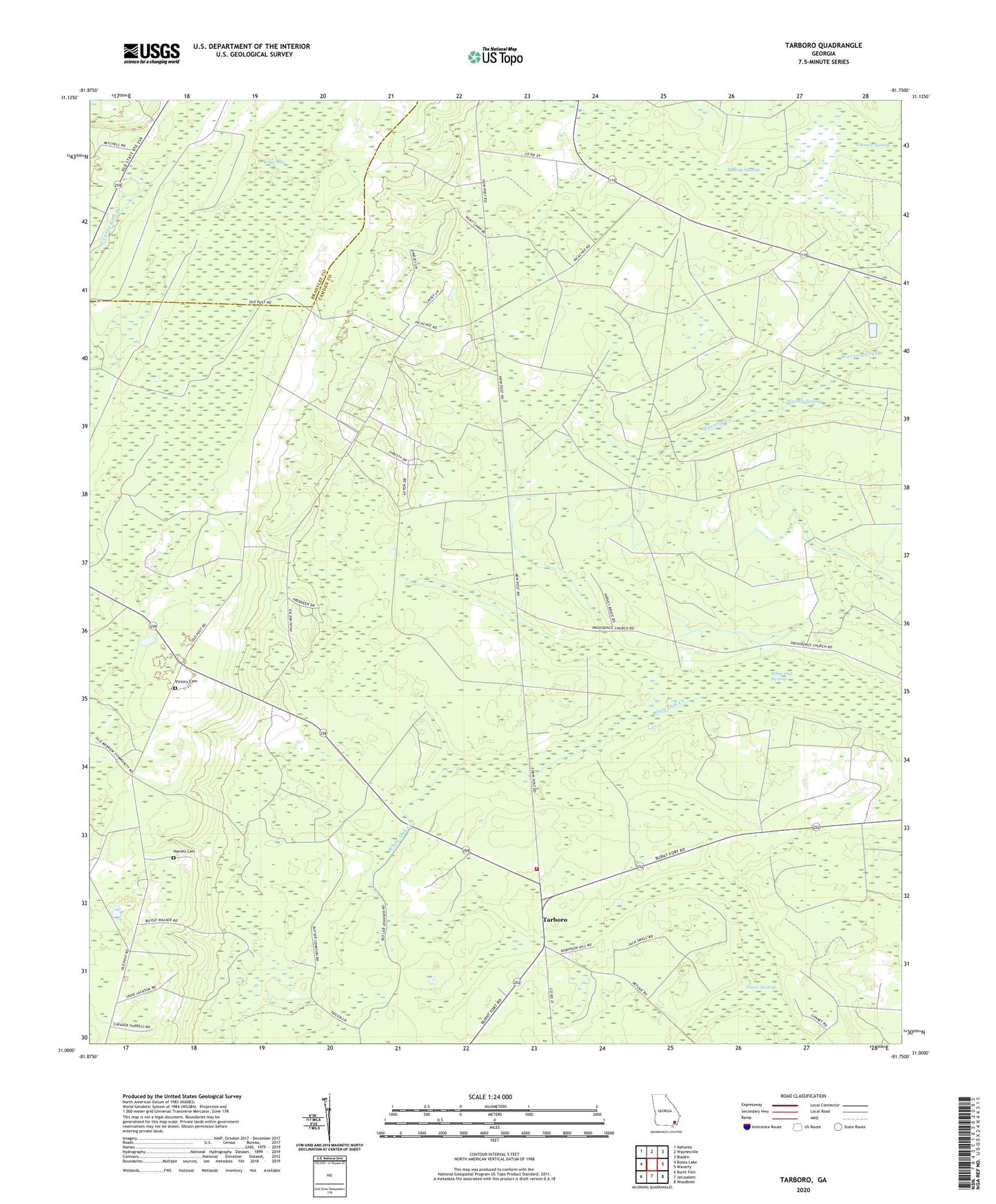
2024 topographic map quadrangle Tarboro in the state of Georgia. Scale: 1:24000. Based on the newly updated USGS 7.5' US Topo map series, this map is in the following counties: Camden, Brantley. The map contains contour data, water features, and other items you are used to seeing on USGS maps, but also has updated roads and other features. This is the next generation of topographic maps. Printed on high-quality waterproof paper with UV fade-resistant inks.
Quads adjacent to this one:
West: Boons Lake
Northwest: Nahunta
North: Waynesville
Northeast: Bladen
East: Waverly
Southeast: Woodbine
South: Jerusalem
Southwest: Burnt Fort
This map covers the same area as the classic USGS quad with code o31081a7.
Contains the following named places: Bickley Chapel, Bixley Chapel, Brown Chapel, Camden County Fire Rescue Station 18, Clarke School, Clinchs Chapel, Goldsborough, Harrell Cemetery, Idlewild Plantation, Incachee Plantation, Kings Bay, Oak Grove Church, Providence Church, Redcap Swamp, Tarboro, Victory Cemetery, Waverly Swamp, White Oak Swamp, Zion Rock Church, ZIP Code: 31568