MyTopo
Nahunta Georgia US Topo Map
Couldn't load pickup availability
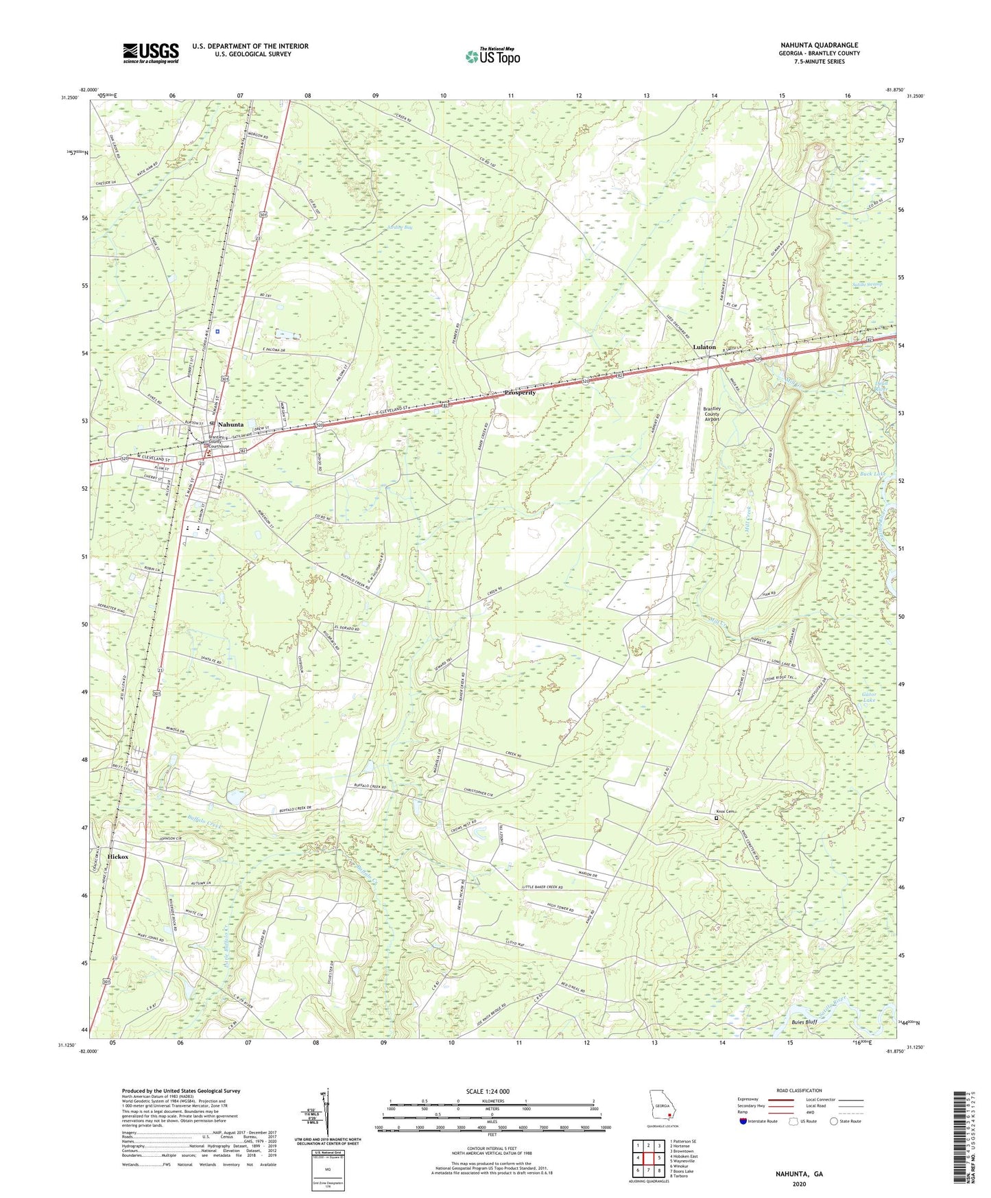
2024 topographic map quadrangle Nahunta in the state of Georgia. Scale: 1:24000. Based on the newly updated USGS 7.5' US Topo map series, this map is in the following counties: Brantley. The map contains contour data, water features, and other items you are used to seeing on USGS maps, but also has updated roads and other features. This is the next generation of topographic maps. Printed on high-quality waterproof paper with UV fade-resistant inks.
Quads adjacent to this one:
West: Hoboken East
Northwest: Patterson SE
North: Hortense
Northeast: Browntown
East: Waynesville
Southeast: Tarboro
South: Boons Lake
Southwest: Winokur
This map covers the same area as the classic USGS quad with code o31081b8.
Contains the following named places: Brantley County, Brantley County Airport, Brantley County Courthouse, Brantley County Emergency Medical Service, Brantley County Jail, Brantley County Sheriff's Office, Buck Lake, Buies Bluff, Buies Camp, Burton Terrace, City of Nahunta, Dead River, First Baptist Church, Gator Lake, Grace Church, Hickox, Hickox Census Designated Place, Jardine Bay, Knox Cemetery, Little Buffalo Church, Little Buffalo Creek, Lulaton, Lulaton Baptist Church, Mill Creek, Nahunta, Nahunta City Hall, Nahunta Division, Nahunta Elementary School, Nahunta Police Department, Nahunta Post Office, Nahunta United Methodist Church, New Hope Church, Pine Bloom School, Prosperity, Raybon Church, Satilla Swamp, Smyrna Church, Southside Baptist Church, Spring Lake, WACL-FM (Waycross), WBGA-FM (Waycross), WBSG-TV (Brunswick), White School, ZIP Code: 31553