MyTopo
Boons Lake Georgia US Topo Map
Couldn't load pickup availability
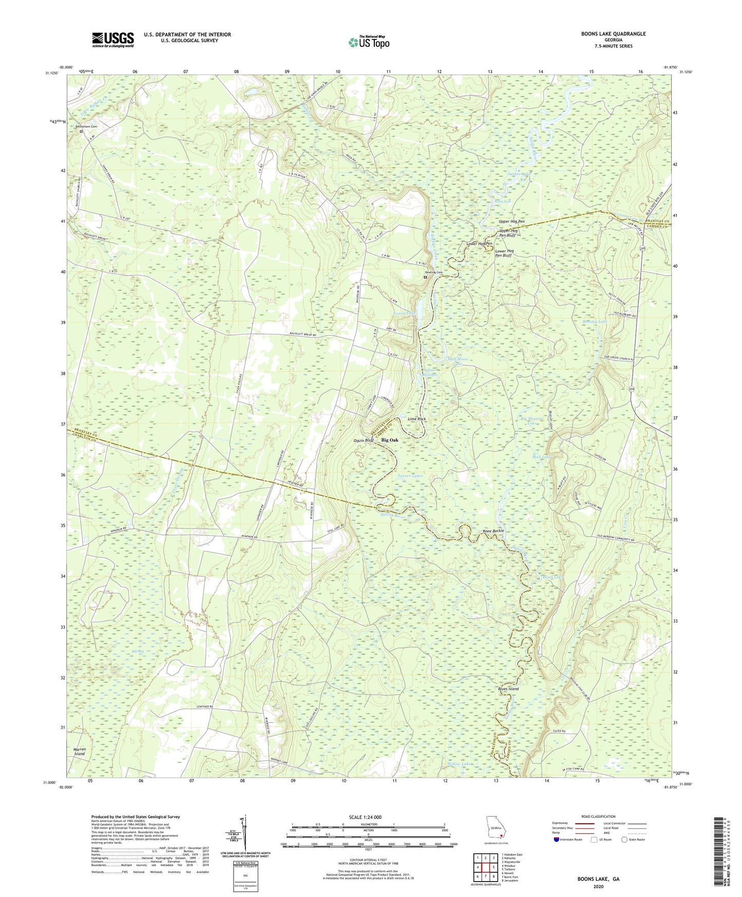
2024 topographic map quadrangle Boons Lake in the state of Georgia. Scale: 1:24000. Based on the newly updated USGS 7.5' US Topo map series, this map is in the following counties: Brantley, Charlton, Camden. The map contains contour data, water features, and other items you are used to seeing on USGS maps, but also has updated roads and other features. This is the next generation of topographic maps. Printed on high-quality waterproof paper with UV fade-resistant inks.
Quads adjacent to this one:
West: Winokur
Northwest: Hoboken East
North: Nahunta
Northeast: Waynesville
East: Tarboro
Southeast: Jerusalem
South: Burnt Fort
Southwest: Newell
This map covers the same area as the classic USGS quad with code o31081a8.
Contains the following named places: Beasley Lake, Bethlehem Cemetery, Bethlehem Church, Big Bay, Big Mineral Lake, Big Oak, Blues Island, Blues Lake, Boons Lake, Box Landing, Buffalo Creek, Buffalo Reaches, County Line Branch, Cow Creek, Davidson Landing, Davidson School, Dowling Cemetery, Dubberly Landing, Gold Mine Landing, Half Moon Lake, Knee Buckle, Knox Suck, Langs Old Still, Lime Rock, Little Mineral Lake, Lower Hog Pen, Lower Hog Pen Bluff, Merrows Landing, Mills Ferry, Mud Lake, Oak Grove Baptist Church, Oak Grove School, Oquin Bluff, Oquin Ferry, Oquin School, Riverside Church, Santee Lake, Slades Old Field Landing, Still Lake, Teston Lake, Turner Lakes, Upper Hog Pen, Upper Hog Pen Bluff, Widow Lake