MyTopo
Waynesville Georgia US Topo Map
Couldn't load pickup availability
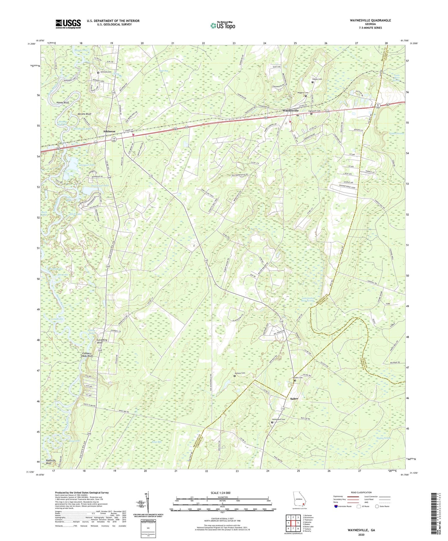
2024 topographic map quadrangle Waynesville in the state of Georgia. Scale: 1:24000. Based on the newly updated USGS 7.5' US Topo map series, this map is in the following counties: Brantley, Camden, Glynn. The map contains contour data, water features, and other items you are used to seeing on USGS maps, but also has updated roads and other features. This is the next generation of topographic maps. Printed on high-quality waterproof paper with UV fade-resistant inks.
Quads adjacent to this one:
West: Nahunta
Northwest: Hortense
North: Browntown
Northeast: Thalmann
East: Bladen
Southeast: Waverly
South: Tarboro
Southwest: Boons Lake
This map covers the same area as the classic USGS quad with code o31081b7.
Contains the following named places: Abrahams Lake, Abrams Bluff, Abrams Bluff Cut, Ammons Cemetery, Ammons Ferry, Ammons Ferry Bridge, Atkinson, Atkinson Baptist Church, Atkinson Lake, Atkinson Volunteer Fire Department, Bonnett Lake, Brailey Swamp, Christian Fellowship Church, Coleridge, Daniels Cemetery, Deerwood Lake, Deerwood Lake Dam, Ditch Lake, Doe Lake, East Side Church, Felton Lake, First African Church, Flanders Shady Bluff, Gibson Cemetery, Golden Isles Speedway, Happy Landing, Heads Lake, Highsmith Cemetery, Homeward Cemetery, Honey Bluff, Hope Chapel, Jackson Cemetery, Julia Lake, King School, Kings Lake, Kings Suck, Knights Swamp, Linda Plantation, Little Rock Church, Little Satilla School, Long Lake, Lord King Bluff, Mount Zion Church, North Camden School, Old Time Church, Palmetto South Church, Pilgrims Rest Church, Radfords Bluff, Riverview School, Salter, Sandhill Church, Sandy Lake, Seals Bay, Seals Branch, Waynesville, Waynesville Census Designated Place, Waynesville Church, Waynesville Division, Waynesville Elementary School, Waynesville Post Office, Waynesville Volunteer Fire Department, Wiggens Cemetery, ZIP Code: 31566