MyTopo
Tempy Georgia US Topo Map
Couldn't load pickup availability
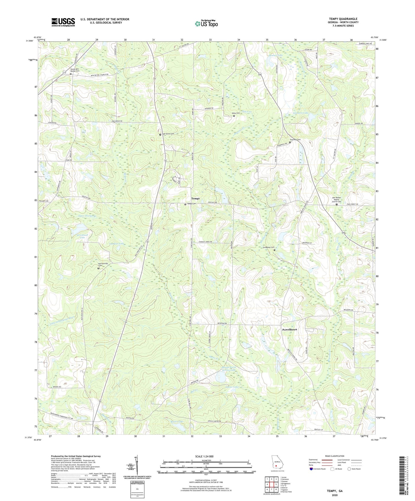
2024 topographic map quadrangle Tempy in the state of Georgia. Scale: 1:24000. Based on the newly updated USGS 7.5' US Topo map series, this map is in the following counties: Worth. The map contains contour data, water features, and other items you are used to seeing on USGS maps, but also has updated roads and other features. This is the next generation of topographic maps. Printed on high-quality waterproof paper with UV fade-resistant inks.
Quads adjacent to this one:
West: Bridgeboro
Northwest: Acree
North: Sylvester
Northeast: Sumner
East: Ty Ty
Southeast: Norman Park
South: Sigsbee
Southwest: Doerun
This map covers the same area as the classic USGS quad with code o31083d7.
Contains the following named places: Beulah Church, Briar Branch, Brown Lake, Brown Lake Dam, Bull Creek, Carter Lake, Carter Lake Dam, Emanuel Church, Evergreen Cemetery, Gordy New Bethel Cemetery, Harrisonville Cemetery, Harrisonville School, Horse Creek, Lumkins Lake, Lumkins Lake Dam, New Bethel Baptist Church Cemetery, New Bethel School, Oak Grove Cemetery, Oak Grove Church, Oak Grove School, Pine Forest Church, Powelltown, Powelltown School, Shingle Farm Service Lake, Shingle Farm Service Lake Dam, Sizemore Lake, Sizemore Lake Dam, Strickland Dam, Strickland Lake, Sumner Lake, Sumner Lake Dam, Tempy, Tempy Cemetery, Tempy Consolidated School, Tempy Methodist Church, Thornhill Cemetery, Tiger Thicket Creek, Town Creek, Willis Cemetery, WSGY-FM (Tifton), Zion Grove Church