MyTopo
Norman Park Georgia US Topo Map
Couldn't load pickup availability
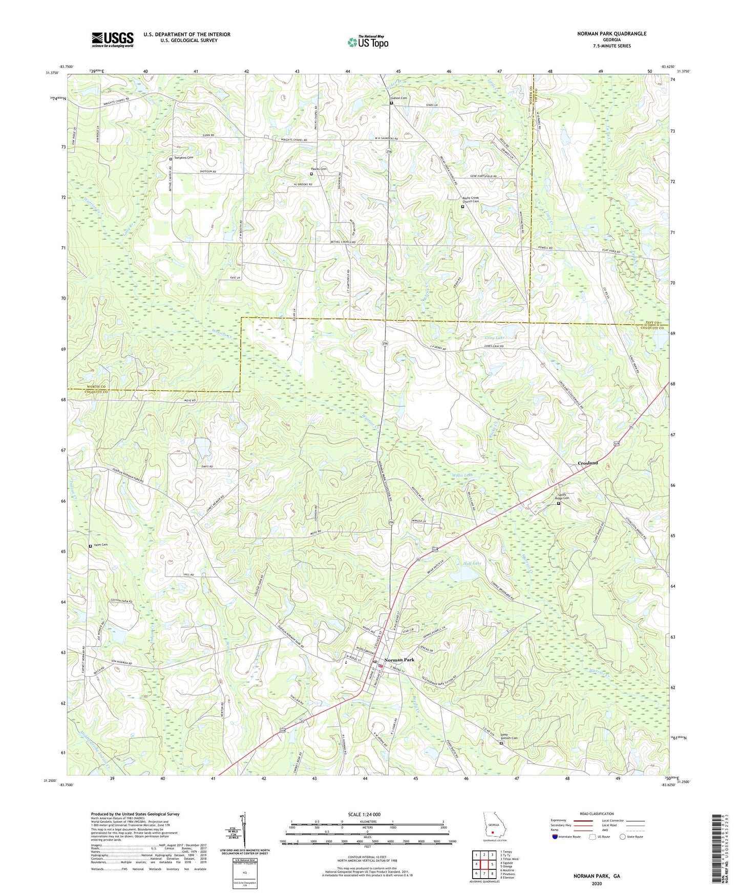
2024 topographic map quadrangle Norman Park in the state of Georgia. Scale: 1:24000. Based on the newly updated USGS 7.5' US Topo map series, this map is in the following counties: Colquitt, Worth, Tift. The map contains contour data, water features, and other items you are used to seeing on USGS maps, but also has updated roads and other features. This is the next generation of topographic maps. Printed on high-quality waterproof paper with UV fade-resistant inks.
Quads adjacent to this one:
West: Sigsbee
Northwest: Tempy
North: Ty Ty
Northeast: Tifton West
East: Omega
Southeast: Ellenton
South: Pineboro
Southwest: Moultrie
This map covers the same area as the classic USGS quad with code o31083c6.
Contains the following named places: Bethel Church, City of Norman Park, Colquitt County Volunteer Firefighters Association Fire Station 21 Norman Park, Crosland, Deep Bottom Cemetery, Galson Cemetery, Gray Lake, Gray Lake Dam, Hall Lake, Hall Lake Dam, Little Branch, Little Creek, Lolly Creek, Mount Zion Church, New Hope Church, Norman College, Norman Park, Norman Park Division, Norman Park Elementary School, Norman Park Police Department, Norman Park Post Office, Paulks Cemetery, Paulks Chapel, Paulks Chapel Consolidated School, Perry School, Pine Level Church, Rocky Creek, Rocky Creek Church, Rocky Creek Church Cemetery, Saint Lukes Church, Sandy Ridge Cemetery, Seizmo School, Southside Church, Tompkins Cemetery, Tucker Branch, Willis Lake, Willis Lake Mission, Yates Cemetery, Zion Church