MyTopo
Thalmann Georgia US Topo Map
Couldn't load pickup availability
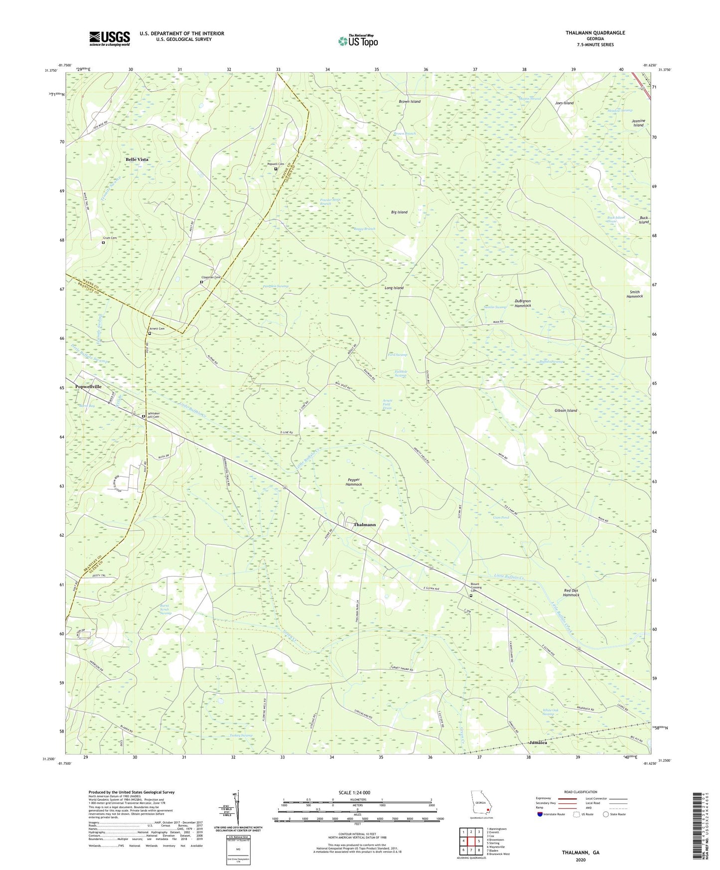
2024 topographic map quadrangle Thalmann in the state of Georgia. Scale: 1:24000. Based on the newly updated USGS 7.5' US Topo map series, this map is in the following counties: Glynn, Wayne, Brantley. The map contains contour data, water features, and other items you are used to seeing on USGS maps, but also has updated roads and other features. This is the next generation of topographic maps. Printed on high-quality waterproof paper with UV fade-resistant inks.
Quads adjacent to this one:
West: Browntown
Northwest: Manningtown
North: Everett
Northeast: Cox
East: Sterling
Southeast: Brunswick West
South: Bladen
Southwest: Waynesville
This map covers the same area as the classic USGS quad with code o31081c6.
Contains the following named places: Akins Pond, Akins Pond Dam, Arnett Cemetery, Arnett Field Drain, Belle Vista, Big Island, Blount Crossing Cemetery, Blunt, Boggy Branch, Brown Branch, Brown Island, Buck Island, Buck Island Drain, Burnt Bay, Burnt Scrub Swamp, Chapman Cemetery, Crum Cemetery, DuBignon Hammock, Fishhole Swamp, Ford, Ford Swamp, Gibson Island, Glynn Missionary Church, Gum Pond, Hopewell Baptist Church, Hopewell School, Jamaica, Jasmine Island, Jenks, Joes Island, Leicht, Liberty Church, Long Island, Lotts, Maple Branch, Martin Strand, Meadow Swamp, Pepper Hammock, Popwell Cemetery, Popwellville, Powder Horn Branch, Pumpkin Swamp, Red Oak Hammock, Smith Hammock, Sumlin Swamp, Tenmile Swamp, Thalmann, Trinity Church, Turkey Swamp, Well Branch, Whitaker Hill Cemetery, White Oak Swamp