MyTopo
Trinity Georgia US Topo Map
Couldn't load pickup availability
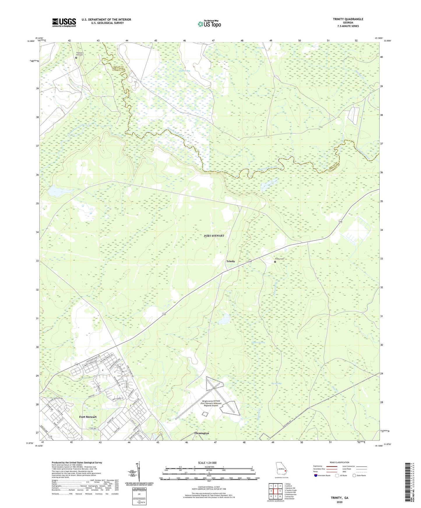
2024 topographic map quadrangle Trinity in the state of Georgia. Scale: 1:24000. Based on the newly updated USGS 7.5' US Topo map series, this map is in the following counties: Liberty, Bryan. The map contains contour data, water features, and other items you are used to seeing on USGS maps, but also has updated roads and other features. This is the next generation of topographic maps. Printed on high-quality waterproof paper with UV fade-resistant inks.
Quads adjacent to this one:
West: Taylors Creek
Northwest: Willie
North: Letford
Northeast: Meldrim SW
East: Limerick NW
Southeast: Dorchester
South: Hinesville
Southwest: Walthourville
This map covers the same area as the classic USGS quad with code o31081h5.
Contains the following named places: Big Swamp, Brittin Elementary School, Bryan Village, Butlers Bridge, Canoochee Creek, Chapel in the Vale, Diamond Elementary School, Fort Stewart, Fort Stewart Census Designated Place, Goshen Swamp, Hallwood Homes, Hinesville - Fort Stewart Water Pollution Control Plant, Hinesville Division, Mellwood School, Riverside School, Stewart Homes, Taylors Creek Golf Course, Thomas Hill Cemetery, Thomas Hill School, Trinity, Trinity Cemetery, Wright Army Airfield (Fort Stewart)/Midcoast Regional Airport, ZIP Code: 31315