MyTopo
Limerick NW Georgia US Topo Map
Couldn't load pickup availability
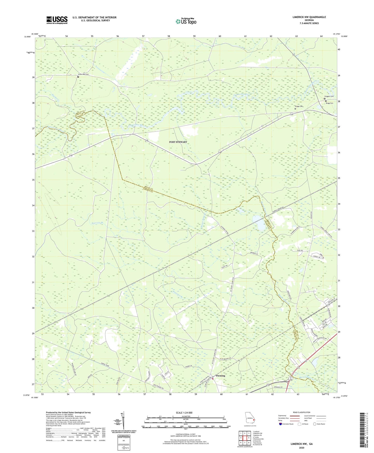
2024 topographic map quadrangle Limerick NW in the state of Georgia. Scale: 1:24000. Based on the newly updated USGS 7.5' US Topo map series, this map is in the following counties: Liberty, Bryan. The map contains contour data, water features, and other items you are used to seeing on USGS maps, but also has updated roads and other features. This is the next generation of topographic maps. Printed on high-quality waterproof paper with UV fade-resistant inks.
Quads adjacent to this one:
West: Trinity
Northwest: Letford
North: Meldrim SW
Northeast: Meldrim SE
East: Richmond Hill
Southeast: Limerick SE
South: Dorchester
Southwest: Hinesville
This map covers the same area as the classic USGS quad with code o31081h4.
Contains the following named places: Bragg Cemetery, Briggs Cemetery, Church of Christ, Dixie Daniel School, Driggers Cemetery, Fleming, Fleming Fire / Rescue Volunteer Department, Fleming Post Office, Green Bay Cemetery, Mount Olivet Church, Raccoon Branch, Savage Creek, Tidewater Experimental Station, Trinity Baptist Church, ZIP Code: 31309