MyTopo
Dorchester Georgia US Topo Map
Couldn't load pickup availability
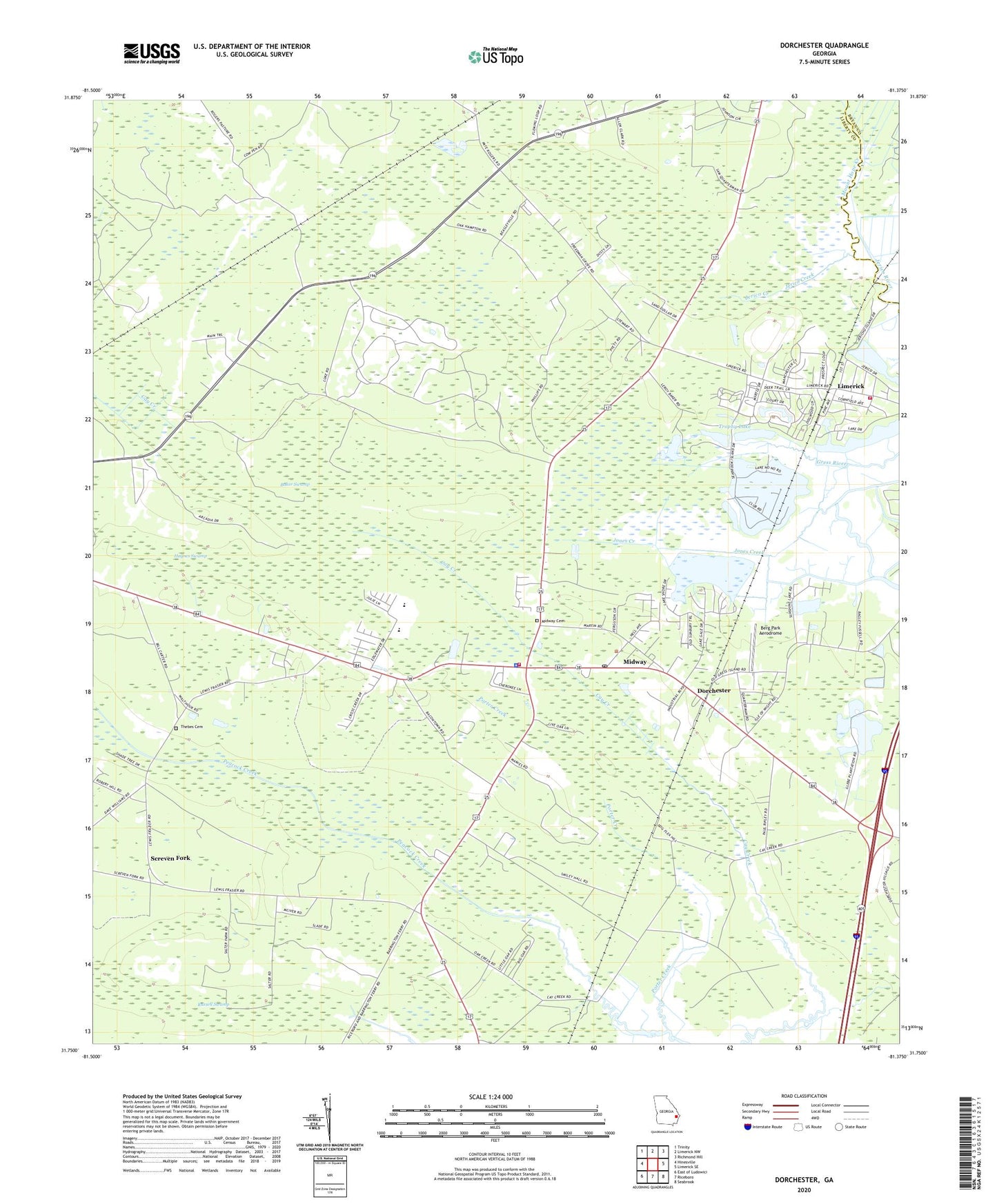
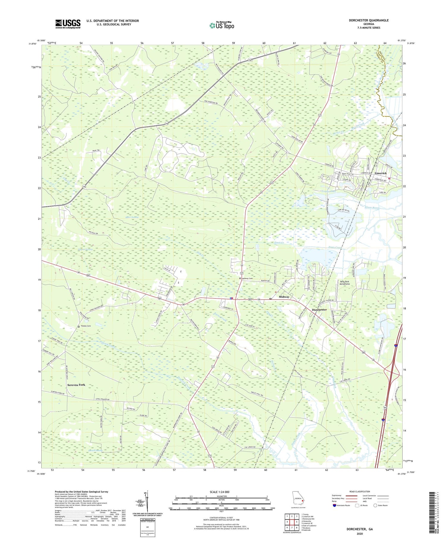
2024 topographic map quadrangle Dorchester in the state of Georgia. Scale: 1:24000. Based on the newly updated USGS 7.5' US Topo map series, this map is in the following counties: Liberty, Bryan. The map contains contour data, water features, and other items you are used to seeing on USGS maps, but also has updated roads and other features. This is the next generation of topographic maps. Printed on high-quality waterproof paper with UV fade-resistant inks.
Quads adjacent to this one:
West: Hinesville
Northwest: Trinity
North: Limerick NW
Northeast: Richmond Hill
East: Limerick SE
Southeast: Seabrook
South: Riceboro
Southwest: East of Ludowici
This map covers the same area as the classic USGS quad with code o31081g4.
Contains the following named places: Baker Swamp, Beech Hill Church, Berg Park Aerodrome, Calvary Church, City of Midway, Claybank School, Community Church, Day Memorial Church, Dorchester, Dorchester Academy, Dorchester Cooperative Center, Ebenezer Church, Faith Mission Church, Fleming Church, Free Branch School, Freedman Grove School, Full Gospel Unity Outreach Center, Georgia Forestry Commission, Gods Divine Healing Temple, Haynes Swamp, Jerico Creek, Lake George Volunteer Fire Department, Liberty County, Liberty Elementary School, Limerick, Midway, Midway Cemetery, Midway Church, Midway Congregational Church, Midway Historic District, Midway Middle School, Midway Police Department, Midway Post Office, Midway Volunteer Fire Department, Moose Hill School, Mount Hope Creek, Porter Creek, Russell Swamp, Saint James Church, Saint Paul Church, Saint Peter Church, Screven Fork, Screven Fork Church, Solomon Temple, Tabernacle of Praise Church, Thebes Cemetery, Trophy Lake, Trophy Lake Dam, Upper Lake George, Upper Lake George Dam