MyTopo
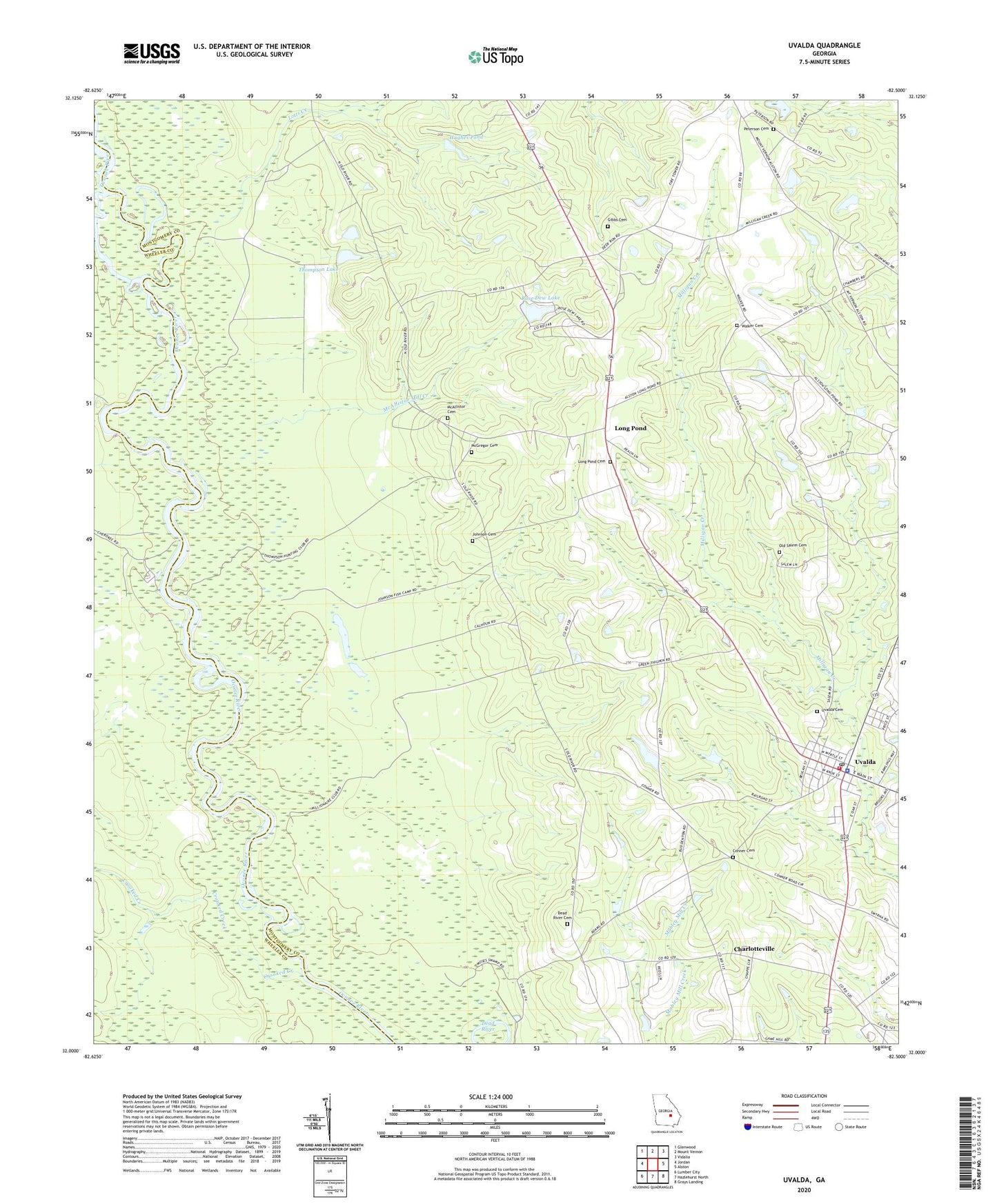
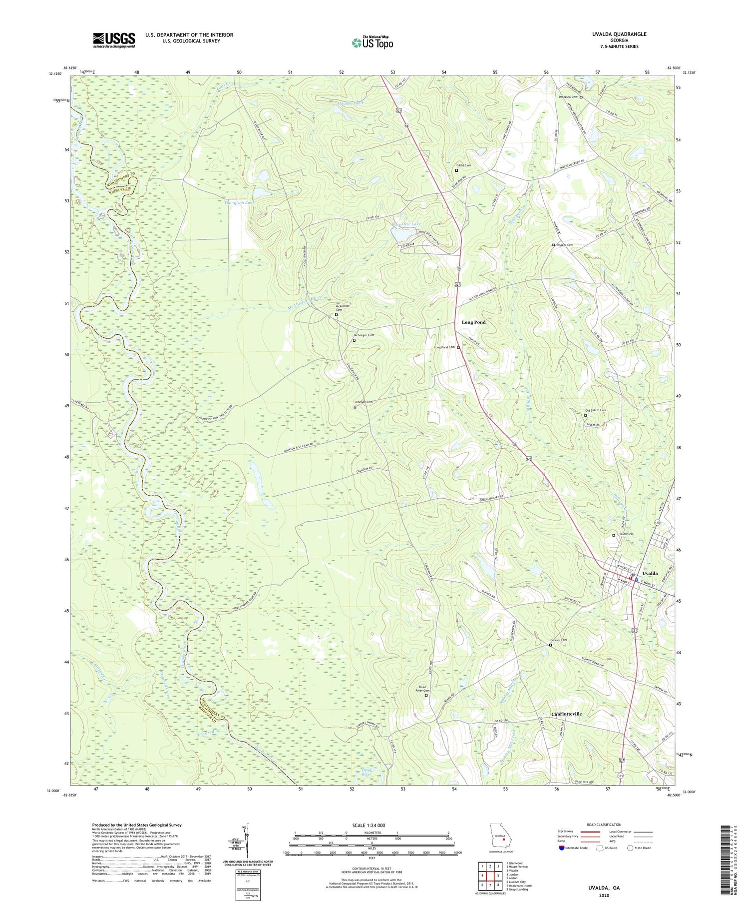
Uvalda Georgia US Topo Map
Couldn't load pickup availability
2024 topographic map quadrangle Uvalda in the state of Georgia. Scale: 1:24000. Based on the newly updated USGS 7.5' US Topo map series, this map is in the following counties: Montgomery, Wheeler. The map contains contour data, water features, and other items you are used to seeing on USGS maps, but also has updated roads and other features. This is the next generation of topographic maps. Printed on high-quality waterproof paper with UV fade-resistant inks.
Quads adjacent to this one:
West: Jordan
Northwest: Glenwood
North: Mount Vernon
Northeast: Vidalia
East: Alston
Southeast: Grays Landing
South: Hazlehurst North
Southwest: Lumber City
This map covers the same area as the classic USGS quad with code o32082a5.
Contains the following named places: Charlotte Church, Charlotteville, City of Uvalda, Conner Cemetery, Crooked Creek, Dead River, Dead River Cemetery, Gibbs Cemetery, Hughes Pond, Hughes Pond Dam, Johnson Cemetery, Long Pond, Long Pond Cemetery, Long Pond Church, Lotts Creek, McAllistor Cemetery, McAllistor Mill Creek, McGregor Cemetery, New Hope Church, Oak Grove Church, Old Salem Cemetery, Peterson Cemetery, Rose Dew Lake, Rose Dew Lake Dam, Saint Johns Church, Thompson Chapel, Thompson Lake, Thompson Lake Dam, Uvalda, Uvalda Cemetery, Uvalda Division, Uvalda Police Department, Uvalda Post Office, Uvalda Volunteer Fire Department, Walker Cemetery