
MyTopo
Lumber City Georgia US Topo Map
Couldn't load pickup availability
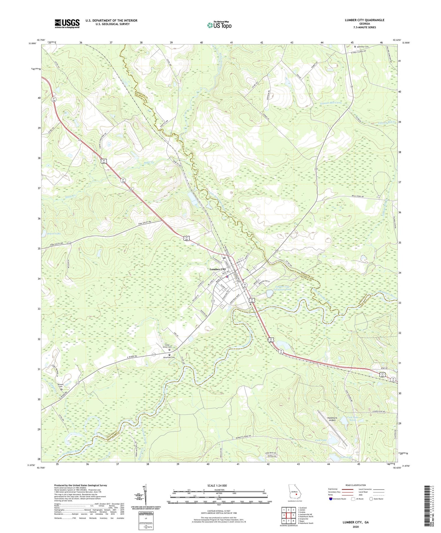
2024 topographic map quadrangle Lumber City in the state of Georgia. Scale: 1:24000. Based on the newly updated USGS 7.5' US Topo map series, this map is in the following counties: Telfair, Wheeler, Jeff Davis. The map contains contour data, water features, and other items you are used to seeing on USGS maps, but also has updated roads and other features. This is the next generation of topographic maps. Printed on high-quality waterproof paper with UV fade-resistant inks.
Quads adjacent to this one:
West: Jacksonville NE
Northwest: Scotland
North: Jordan
Northeast: Uvalda
East: Hazlehurst North
Southeast: Hazlehurst South
South: Roper
Southwest: Snipesville
This map covers the same area as the classic USGS quad with code o31082h6.
Contains the following named places: Alligator Creek, Brewer Cemetery, Cedar Grove Cemetery, City of Lumber City, Cook Lake, Cook Lake Dam, Cook Lake Dam North, Cook Lake North, Currie Creek, Fishing Creek, Hard Bargain Landing, Hazlehurst Airport, Little Ocmulgee River, Lumber City, Lumber City City Hall, Lumber City Elementary School, Lumber City Ferry, Lumber City Jail, Lumber City Landing, Lumber City Oxidation Pond, Lumber City Oxidation Pond Dam, Lumber City Police Department, Lumber City Post Office, Lumber City Volunteer Fire Department, McArthur Cemetery, Murdock McRaes Landing, Newton Creek, Ocmulgee Academy, Powell Lake, Powell Lake Dam, Riverside Cemetery, Saint James Christian Methodist Episcopal Church, Saint Paul Church, Sears Lake, Skippers Landing, Sugar Creek, Tillman Mill Creek, Walkers Camp, ZIP Code: 31549


