MyTopo
Hazlehurst North Georgia US Topo Map
Couldn't load pickup availability
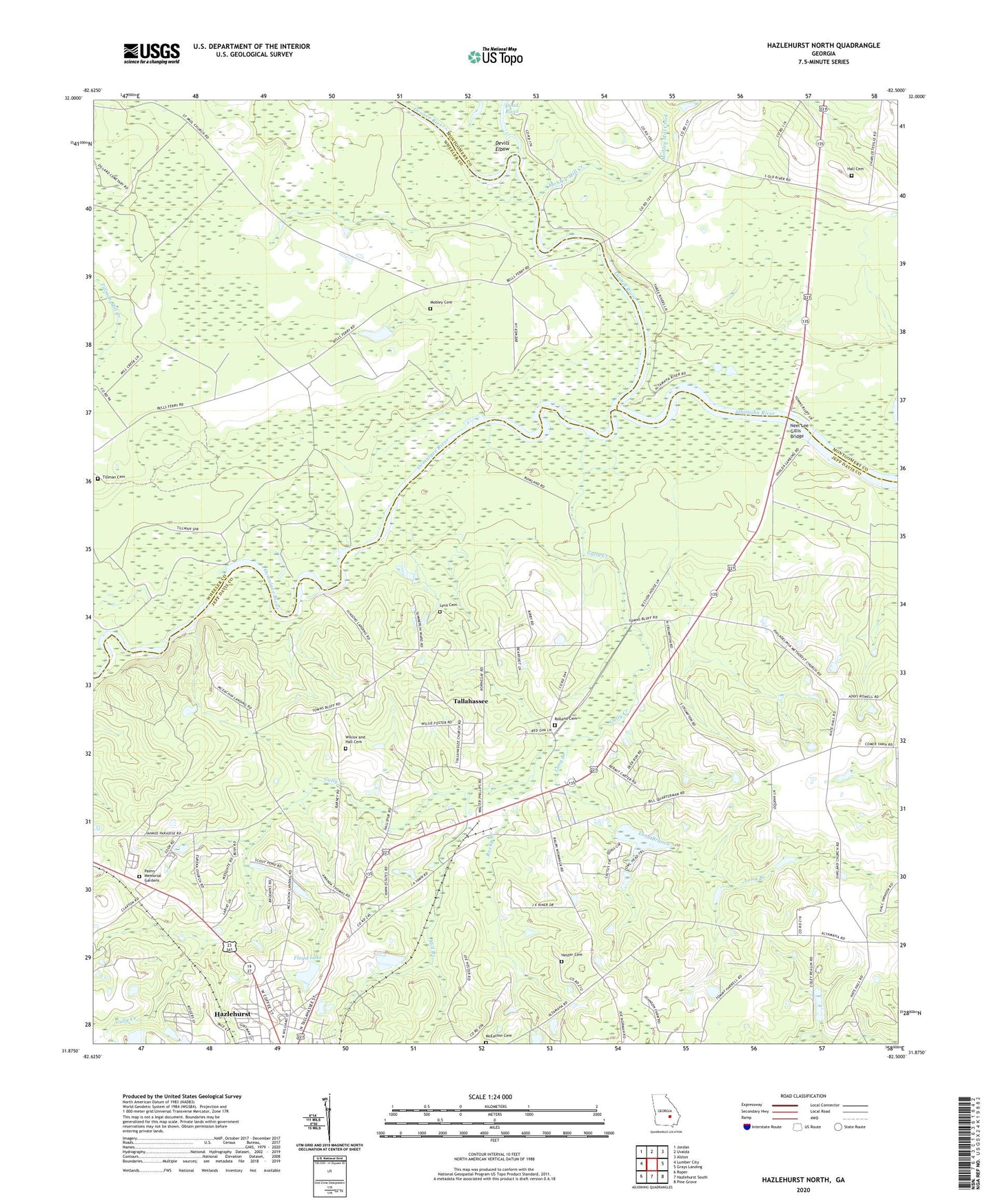
2024 topographic map quadrangle Hazlehurst North in the state of Georgia. Scale: 1:24000. Based on the newly updated USGS 7.5' US Topo map series, this map is in the following counties: Jeff Davis, Wheeler, Montgomery. The map contains contour data, water features, and other items you are used to seeing on USGS maps, but also has updated roads and other features. This is the next generation of topographic maps. Printed on high-quality waterproof paper with UV fade-resistant inks.
Quads adjacent to this one:
West: Lumber City
Northwest: Jordan
North: Uvalda
Northeast: Alston
East: Grays Landing
Southeast: Pine Grove
South: Hazlehurst South
Southwest: Roper
This map covers the same area as the classic USGS quad with code o31082h5.
Contains the following named places: Bells Ferry Landing, Big Bethel Church, Devils Elbow, Eureka Church, Floyd Lake, Floyd Lake Dam, Gully Creek, Hall Cemetery, Halls Spur, Hallspur Church, Hester Cemetery, Hinsons Still, Jeff Davis Country Club, Liberty Church, Lind Landing, Long Branch, Lynn Cemetery, McEachin Cemetery, McEachins Landing, McEachins Woodyard Landing, Mill Branch, Mobley Cemetery, Mobley Mill Creek, Neel Lee Gillis Bridge, North Gate Baptist Church, Oakland Church, Ocmulgee River, Oconee River, Orico, Palms Memorial Gardens, Philadelphia Church, Rocky Branch, Rolland Cemetery, Round Bluff Landing, Tallahassee, Tillman Cemetery, Town Bluff Ferry, Town Bluff Landing, Warehouse Landing, Wilcox and Hall Cemetery