
MyTopo
Whitesville Georgia US Topo Map
Couldn't load pickup availability
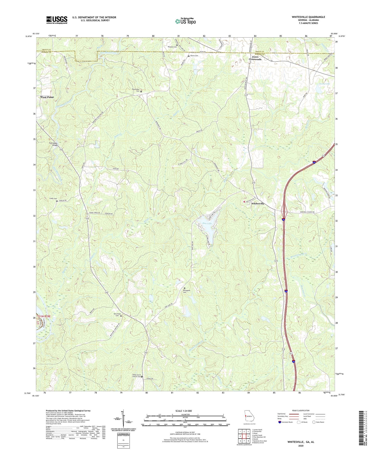
2024 topographic map quadrangle Whitesville in the state of Georgia. Scale: 1:24000. Based on the newly updated USGS 7.5' US Topo map series, this map is in the following counties: Harris, Troup, Chambers. The map contains contour data, water features, and other items you are used to seeing on USGS maps, but also has updated roads and other features. This is the next generation of topographic maps. Printed on high-quality waterproof paper with UV fade-resistant inks.
Quads adjacent to this one:
West: Lanett South
Northwest: Lanett North
North: Cannonville
Northeast: Hilyer
East: Pine Mountain SW
Southeast: Mulberry Grove
South: Bartletts Ferry Dam
Southwest: Beulah
This map covers the same area as the classic USGS quad with code o32085g1.
Contains the following named places: Avery Lake, Avery Lake Dam, Big Branch, Billingslea Cemetery, Callaway Enterprises Lake, Callaway Enterprises Lake Dam, Cooks Cemetery, Flat Shoal Church, Flat Shoals Bridge, House Creek, Hutchinson Cemetery, Ingram Creek, Jackson Recreation Center, Johnson School, Jones Crossroads, Little Creek, Mountain Creek, New Hope, New Hope Cemetery, New Hope Methodist Church, Northwest Harris Volunteer Fire Department, Pearson Mill, Pine Lake, Pine Mountain Division, Rivers Cemetery, Sand Creek, Shady Grove, Shady Grove Church, Shady Grove Church Cemetery, Union Church, Whitesville, Williams Cemetery, ZIP Code: 31833


