MyTopo
Makaopuhi Crater Hawaii US Topo Map
Couldn't load pickup availability
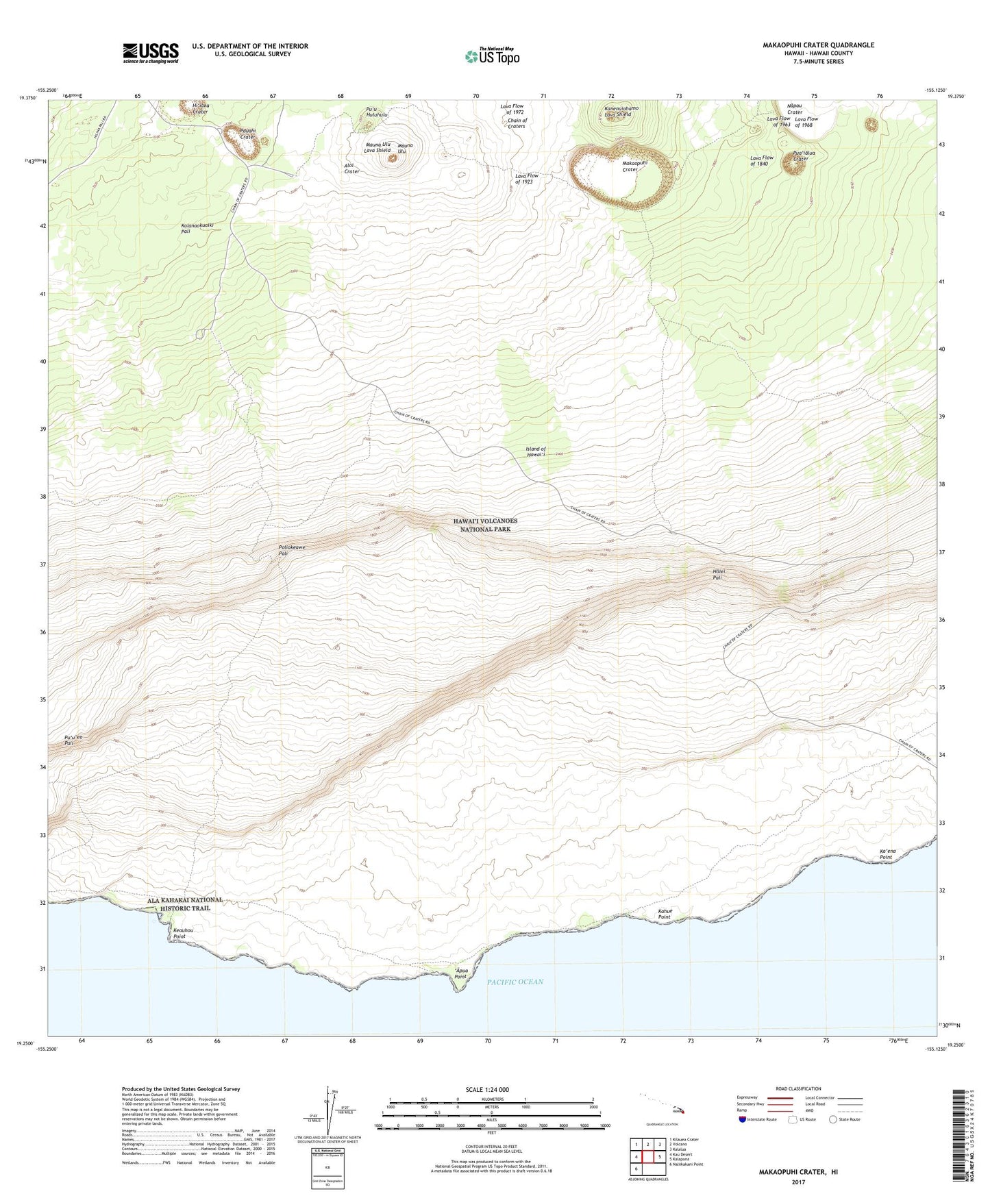
2024 topographic map quadrangle Makaopuhi Crater in the state of Hawaii. Scale: 1:24000. Based on the newly updated USGS 7.5' US Topo map series, this map is in the following counties: Hawaii. The map contains contour data, water features, and other items you are used to seeing on USGS maps, but also has updated roads and other features. This is the next generation of topographic maps. Printed on high-quality waterproof paper with UV fade-resistant inks.
Quads adjacent to this one:
West: Kau Desert
Northwest: Kilauea Crater
North: Volcano
Northeast: Kalalua
East: Kalapana
Southwest: Naliikakani Point
This map covers the same area as the classic USGS quad with code o19155c2.
Contains the following named places: Ainahou Ranch, 'Alae Crater, Alanui Kahiko Overlook, 'Alo'i Crater, 'Apua, 'Apua Point, Chain of Craters, Halona Kahakai Overlook, Hi'iaka Crater, Holei Pali, Holei Pali Overlook, Ka'ena Point, Kahue, Kahue Point, Kanenuiohamo, Kealakomo, Keauhou Landing, Keauhou Point, Keauhou Shelter, Keauhou Trail, Kipuka Kahali'i Overlook, Kulanaokuaiki Pali, Lava Flow of 1840, Lava Flow of 1923, Lava Flow of 1968, Lava Flow of 1972, Makaopuhi Crater, Mau Loa o Maunaulu, Maunaulu, Maunaulu Lava Shield, Muliwai a Pele Overlook, Napau Crater, Napau Crater Trail, Naulu Forest, Naulu Trail, Panau Nui, Pauahi Crater, Poliokeawe Pali, Pua'ialua Crater, Puna Ka'u Trail, Pu'u'eo Pali, Pu'uhuluhulu