
MyTopo
Volcano Hawaii US Topo Map
Couldn't load pickup availability
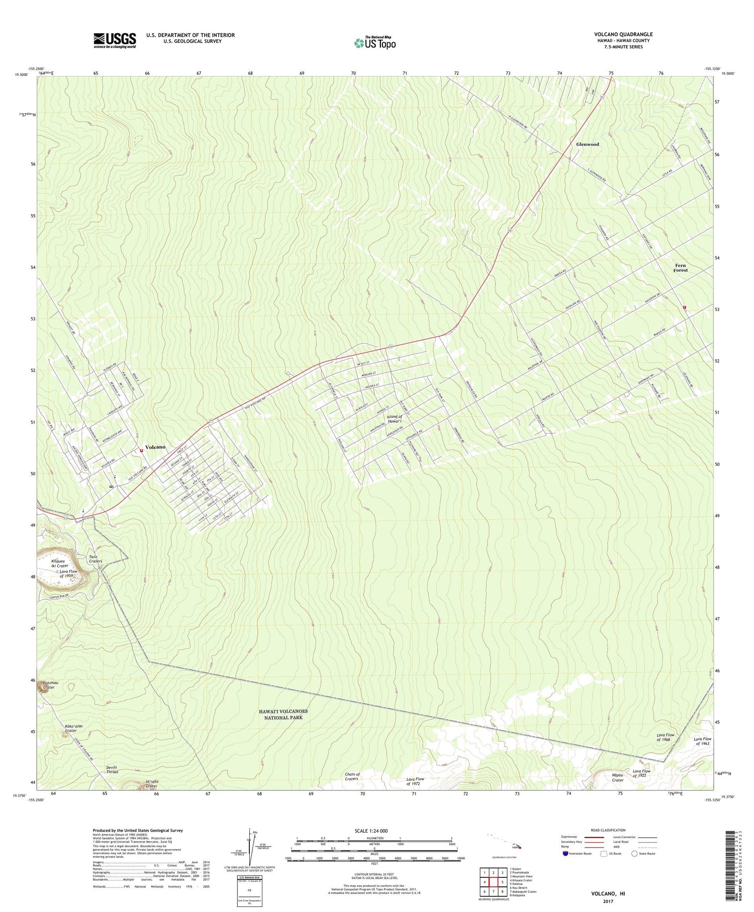
2024 topographic map quadrangle Volcano in the state of Hawaii. Scale: 1:24000. Based on the newly updated USGS 7.5' US Topo map series, this map is in the following counties: Hawaii. The map contains contour data, water features, and other items you are used to seeing on USGS maps, but also has updated roads and other features. This is the next generation of topographic maps. Printed on high-quality waterproof paper with UV fade-resistant inks.
Quads adjacent to this one:
West: Kilauea Crater
Northwest: Kulani
North: Puumakaala
Northeast: Mountain View
East: Kalalua
Southeast: Kalapana
South: Makaopuhi Crater
Southwest: Kau Desert
This map covers the same area as the classic USGS quad with code o19155d2.
Contains the following named places: Devils Throat, Fern Forest, Fern Forest Census Designated Place, Fern Forest Volunteer Fire Station 5C, Glenwood, Japanese School, Ka'ohe-'ola'a Hawaiian Home Land, Keakealani School, Kilauea Iki Crater, Kilauea Settlement Lots, Ko'oko'olau Crater, Lava Flow of 1922, Lava Flow of 1963, Mauna Loa Estates, Mauna Loa Estates Census Designated Place, 'Ola'a Forest, 'Ola'a Forest Park Reserves, 'Ola'a Summer Lots, Puhimau Crater, Royal Hawaiian Estates, Royal Hawaiian Estates Census Designated Place, Twin Craters, Volcano, Volcano Post Office, Volcano Village Volunteer Fire Station 19A


