MyTopo
Kilauea Crater Hawaii US Topo Map
Couldn't load pickup availability
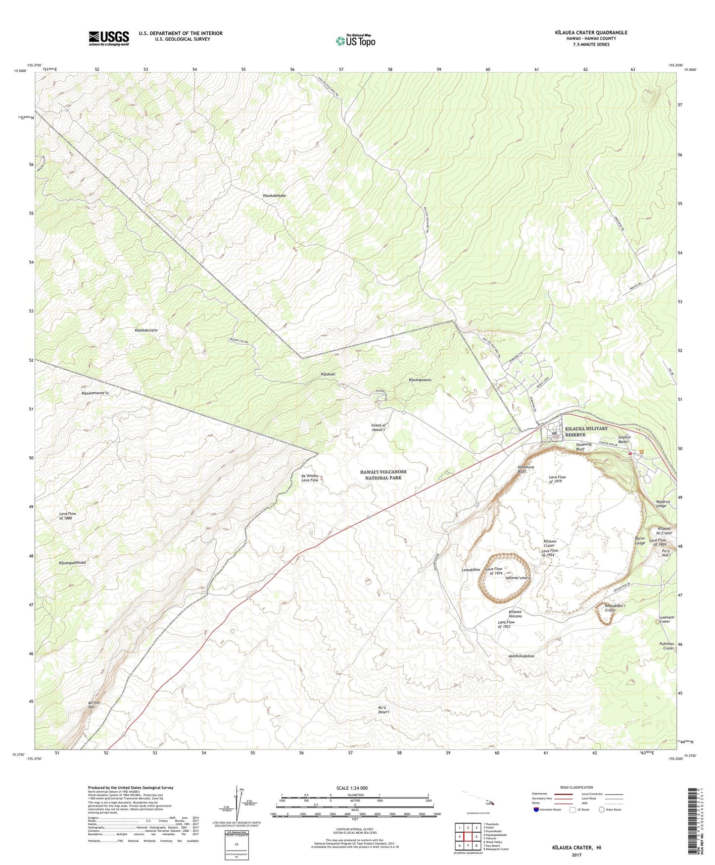
2024 topographic map quadrangle Kilauea Crater in the state of Hawaii. Scale: 1:24000. Based on the newly updated USGS 7.5' US Topo map series, this map is in the following counties: Hawaii. The map contains contour data, water features, and other items you are used to seeing on USGS maps, but also has updated roads and other features. This is the next generation of topographic maps. Printed on high-quality waterproof paper with UV fade-resistant inks.
Quads adjacent to this one:
West: Kipukapakekake
Northwest: Puuulaula
North: Kulani
Northeast: Puumakaala
East: Volcano
Southeast: Makaopuhi Crater
South: Kau Desert
Southwest: Wood Valley
This map covers the same area as the classic USGS quad with code o19155d3.
Contains the following named places: Byron Ledge, Byron Ledge Trail, Crater Rim Trail, Devastation Trail, East Rift Zone, Halema'uma'u, Halema'uma'u Overlook, Halema'uma'u Parking Area, Halema'uma'u Trail, Hawaii County Fire Department Station 19 Volcano, Hawaii National Park Post Office, Hawaiian Volcano Observatory, 'Iliahi Trail, Ka'oiki Pali, Ke'amoku Lava Flow, Keanakako'i Crater, Keanakako'i Overlook, Keauhou, Keauhou Ranch, Kilauea, Kilauea Crater, Kilauea Forest Reserve, Kilauea Iki Trail, Kilauea Military Camp, Kilauea Overlook, Kipukakekake, Kipukaki, Kipukakulalio, Kipukapuaulu, Lava Flow of 1919, Lava Flow of 1921, Lava Flow of 1954, Lava Flow of 1959, Lava Flow of 1974, Little Beggar Trail, Luamanu Crater, Namakanipaio Campground, 'Ohaikea, 'Ohaikea Houses, Pu'upua'i, Pu'upua'i Overlook, Rainshed Heliport, Southwest Rift Overlook, Southwest Rift Zone, Steaming Bluff, Sulphur Banks, Sulphur Banks Trail, Uekahuna Bluff, Volcano Census Designated Place, Volcano Golf Course Census Designated Place, Volcano House, Waldron Ledge