MyTopo
Puaakala Hawaii US Topo Map
Couldn't load pickup availability
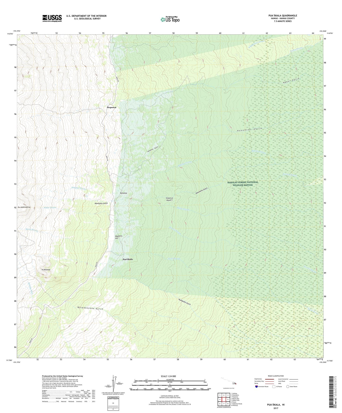
2024 topographic map quadrangle Puaakala in the state of Hawaii. Scale: 1:24000. Based on the newly updated USGS 7.5' US Topo map series, this map is in the following counties: Hawaii. The map contains contour data, water features, and other items you are used to seeing on USGS maps, but also has updated roads and other features. This is the next generation of topographic maps. Printed on high-quality waterproof paper with UV fade-resistant inks.
Quads adjacent to this one:
West: Mauna Kea
Northwest: Umikoa
North: Keanakolu
Northeast: Papaaloa
East: Akaka Falls
Southeast: Piihonua
South: Waikoloa Ponds
Southwest: Puuoo
Contains the following named places: A'ahuwela, Hakalau Forest National Wildlife Refuge, Hilo Closed Watershed, Hilo Forest Reserve, Honohina, Hopuwai, Kaloaloa, Kanakaleonui Cabin, Kanakaleonui Ranger Station, Laumai'a, Magnetic Hill, Maulua Trail, Nauhi Camp, Nawaiehu Gulch, North Hilo District, Nukupahu Gulch, Pihonua Hawaiian Home Land, Pua'akala, South Hilo District, Spring Water Camp