MyTopo
Piihonua Hawaii US Topo Map
Couldn't load pickup availability
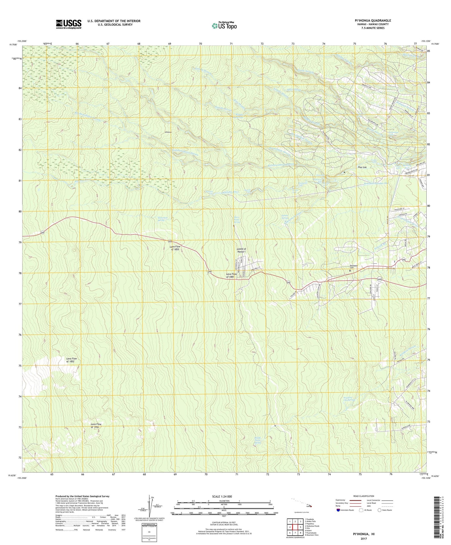
2024 topographic map quadrangle Piihonua in the state of Hawaii. Scale: 1:24000. Based on the newly updated USGS 7.5' US Topo map series, this map is in the following counties: Hawaii. The map contains contour data, water features, and other items you are used to seeing on USGS maps, but also has updated roads and other features. This is the next generation of topographic maps. Printed on high-quality waterproof paper with UV fade-resistant inks.
Quads adjacent to this one:
West: Waikoloa Ponds
Northwest: Puaakala
North: Akaka Falls
Northeast: Papaikou
East: Hilo
Southeast: Mountain View
South: Puumakaala
Southwest: Kulani
This map covers the same area as the classic USGS quad with code o19155f2.
Contains the following named places: Aale Stream, 'Akolea Plantation Estates, 'Awehi Stream, Boiling Pots, Camp Five, Camp Four, Hawaii Falls, Hilo Country Club, Hilo Division, Hookelekele Stream, Japanese School, Kahoama Stream, Kalalau, Kalohewahewa Stream, Kaluiiki Branch, Kapehu Springs, Kapehu Stream, Kaumana, Kaumana Caves County Park, Kaumana Cemetery, Kaumana Elementary School, Kaumana Hawaiian Home Land, Kaumana Homesteads, Kauwehu Falls, KGMD-TV (Hilo), Kipi Stream, Koakanini Falls, KuKuau One, Kukuau Two, Kulaniapia Falls, KWXXFM-FM (Hilo), Laualu Stream, Lauiole Falls, Lelekaae Falls, Lyman Spring, Middle Flume House, Middle Flume Spring, Nakakauila Stream, 'Ola'a Flume Spring, Pakaluahine Stream, Peepee Falls, Pi'ihonua, Poakana Falls, Ponahawai, Ponahawai Homesteads, Pukamaui Falls, Punahoa, Punahoa One, Punahoa Two, Pu'u'eo, Pu'uloa, Reservoir Number One, Waiakea-Uka Springs, Waiale Falls, Wailoa Falls, Waterhole Spring, ZIP Code: 96720