MyTopo
Waikoloa Ponds Hawaii US Topo Map
Couldn't load pickup availability
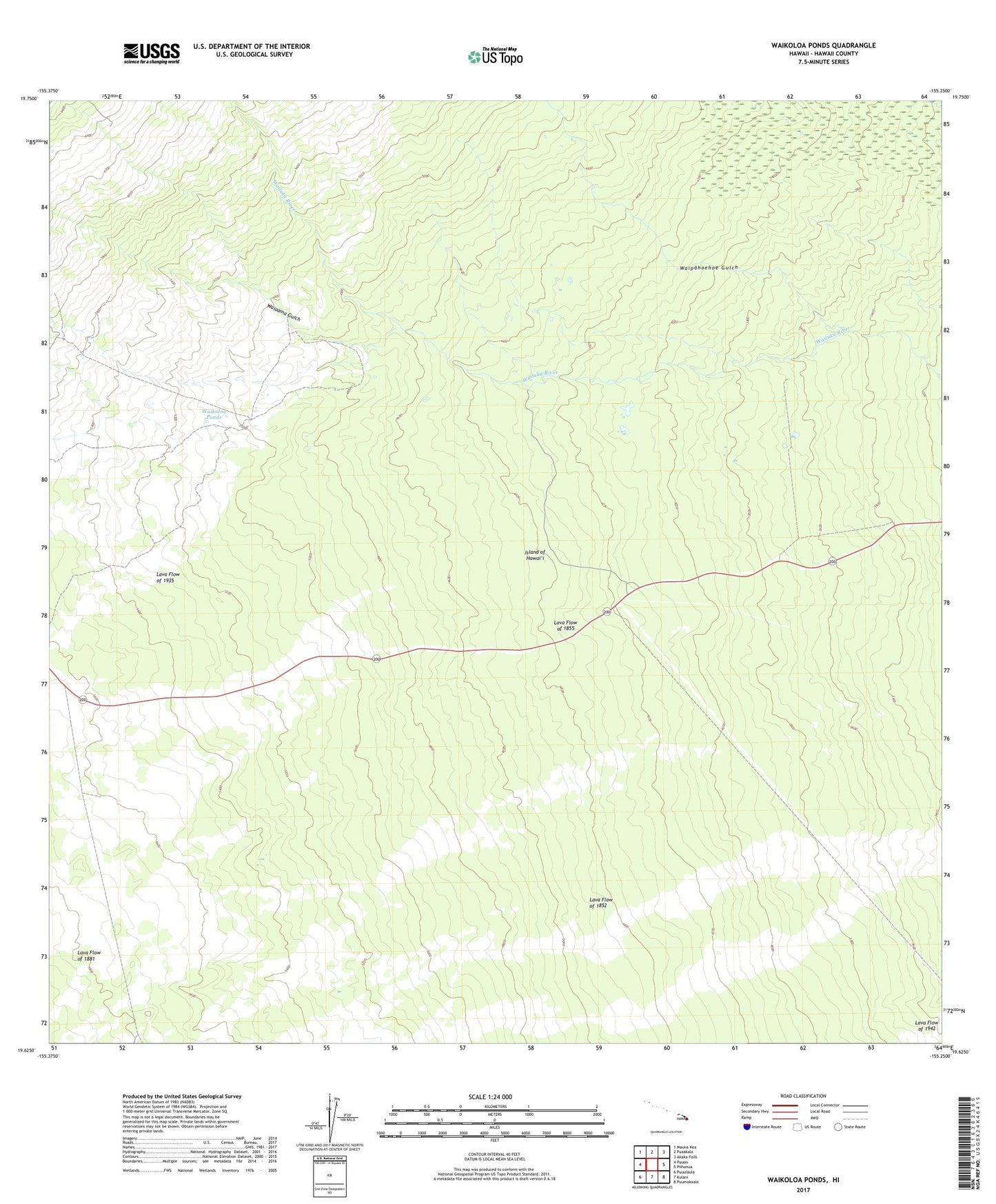
2024 topographic map quadrangle Waikoloa Ponds in the state of Hawaii. Scale: 1:24000. Based on the newly updated USGS 7.5' US Topo map series, this map is in the following counties: Hawaii. The map contains contour data, water features, and other items you are used to seeing on USGS maps, but also has updated roads and other features. This is the next generation of topographic maps. Printed on high-quality waterproof paper with UV fade-resistant inks.
Quads adjacent to this one:
West: Puuoo
Northwest: Mauna Kea
North: Puaakala
Northeast: Akaka Falls
East: Piihonua
Southeast: Puumakaala
South: Kulani
Southwest: Puuulaula
Contains the following named places: Lava Flow of 1852, Lava Flow of 1855, Lava Flow of 1881, Mawae, Pi'ihonua, Pu'u'o'o Volcano Trail, Upper Waiakea Forest Reserve, Waiaama Gulch, Waikoloa Ponds, Waipahoehoe Gulch