MyTopo
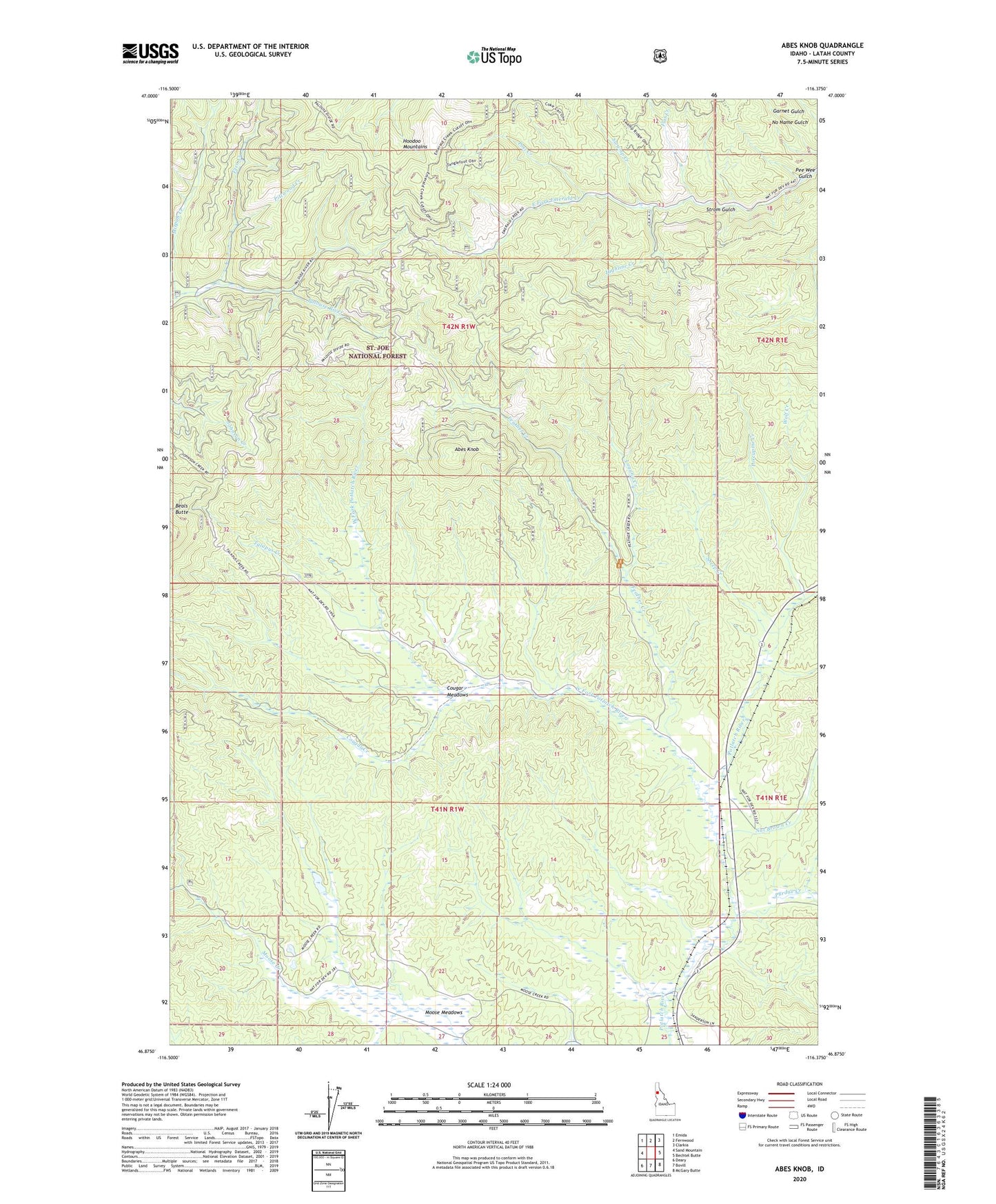
Abes Knob Idaho US Topo Map
Couldn't load pickup availability
Also explore the Abes Knob Forest Service Topo of this same quad for updated USFS data
2024 topographic map quadrangle Abes Knob in the state of Idaho. Scale: 1:24000. Based on the newly updated USGS 7.5' US Topo map series, this map is in the following counties: Latah. The map contains contour data, water features, and other items you are used to seeing on USGS maps, but also has updated roads and other features. This is the next generation of topographic maps. Printed on high-quality waterproof paper with UV fade-resistant inks.
Quads adjacent to this one:
West: Sand Mountain
Northwest: Emida
North: Fernwood
Northeast: Clarkia
East: Bechtel Butte
Southeast: McGary Butte
South: Bovill
Southwest: Deary
This map covers the same area as the classic USGS quad with code o46116h4.
Contains the following named places: Abes Knob, Cougar Creek, Cougar Meadows, Feather Creek, Fern Creek, Flat Creek, Highline Creek, Laguna Creek, Mizpah Mine, Moose Meadows, Nat Brown Creek, Pee Wee Gulch, Pittwood Creek, Porcupine Creek, Post Creek, Purdue, Purdue Creek, Sheep Creek, Strom Gulch, Swamp Creek, Talapus Creek, West Fork Potlatch River, Wolf Creek