
MyTopo
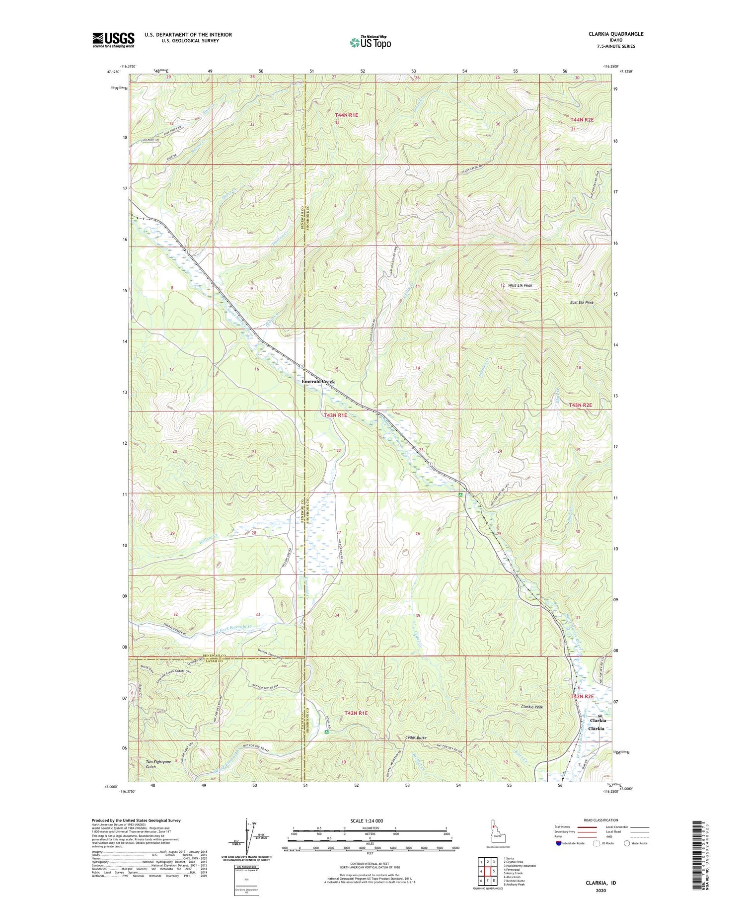
Clarkia Idaho US Topo Map
Couldn't load pickup availability
Also explore the Clarkia Forest Service Topo of this same quad for updated USFS data
2024 topographic map quadrangle Clarkia in the state of Idaho. Scale: 1:24000. Based on the newly updated USGS 7.5' US Topo map series, this map is in the following counties: Shoshone, Benewah, Latah. The map contains contour data, water features, and other items you are used to seeing on USGS maps, but also has updated roads and other features. This is the next generation of topographic maps. Printed on high-quality waterproof paper with UV fade-resistant inks.
Quads adjacent to this one:
West: Fernwood
Northwest: Santa
North: Crystal Peak
Northeast: Huckleberry Mountain
East: Merry Creek
Southeast: Anthony Peak
South: Bechtel Butte
Southwest: Abes Knob
This map covers the same area as the classic USGS quad with code o47116a3.
Contains the following named places: Adams Creek, Blair Creek, Cedar Butte, Cedar Creek, Cedar Creek Campground, Childs Creek, Clarkia, Clarkia Contract Postal Unit, Clarkia Peak, Clarkia Work Center, East Elk Peak, East Fork Emerald Creek, Emerald Creek, Emerald Creek Campground, Estes Creek, Hatton Creek, Jims Spur, Middle Fork Saint Maries River, Olson Creek, Pierce Creek, Staples Creek, West Elk Peak, West Fork Emerald Creek, West Fork Saint Maries River, Willow Creek, ZIP Code: 83830


