MyTopo
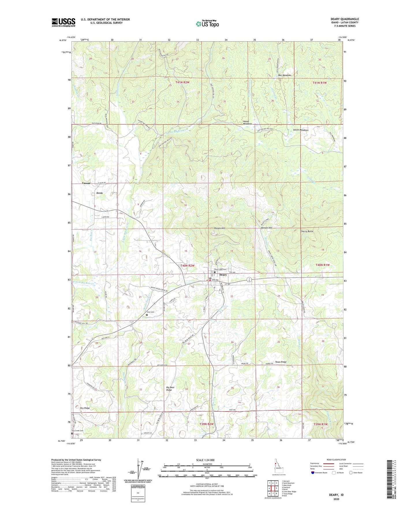
Deary Idaho US Topo Map
Couldn't load pickup availability
Also explore the Deary Forest Service Topo of this same quad for updated USFS data
2024 topographic map quadrangle Deary in the state of Idaho. Scale: 1:24000. Based on the newly updated USGS 7.5' US Topo map series, this map is in the following counties: Latah. The map contains contour data, water features, and other items you are used to seeing on USGS maps, but also has updated roads and other features. This is the next generation of topographic maps. Printed on high-quality waterproof paper with UV fade-resistant inks.
Quads adjacent to this one:
West: Stanford
Northwest: Harvard
North: Sand Mountain
Northeast: Abes Knob
East: Bovill
Southeast: Park
South: Texas Ridge
Southwest: Little Bear Ridge
This map covers the same area as the classic USGS quad with code o46116g5.
Contains the following named places: Avon, Benson Hill, Brush Creek, Cherry Butte, City of Deary, Deary, Deary Post Office, Deary Rural Fire District, Deary School, Dry Creek Cemetery, East Fork Big Bear Creek, Middle Fork Big Bear Creek, Mount Deary Creek, Pine Crest Cemetery, Potato Hill, Schwartz Creek, Smith Meadows, Vassar, Vassar Meadows, West Fork Big Bear Creek, West Fork Corral Creek, Wet Meadows, Zion Cemetery, ZIP Code: 83823