MyTopo
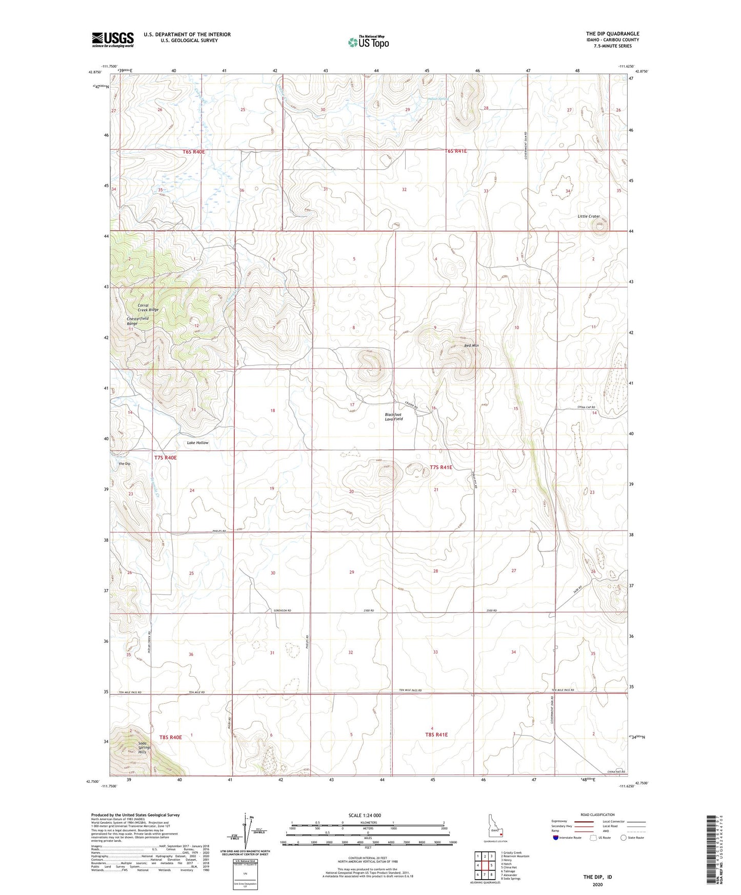
The Dip Idaho US Topo Map
Couldn't load pickup availability
2023 topographic map quadrangle The Dip in the state of Idaho. Scale: 1:24000. Based on the newly updated USGS 7.5' US Topo map series, this map is in the following counties: Caribou. The map contains contour data, water features, and other items you are used to seeing on USGS maps, but also has updated roads and other features. This is the next generation of topographic maps. Printed on high-quality waterproof paper with UV fade-resistant inks.
Quads adjacent to this one:
West: Hatch
Northwest: Grizzly Creek
North: Reservoir Mountain
Northeast: Henry
East: China Hat
Southeast: Soda Springs
South: Alexander
Southwest: Talmage
This map covers the same area as the classic USGS quad with code o42111g6.
Contains the following named places: Blackfoot Lava Field, Chesterfield Range, Corral Creek Ridge, Indian Spring, Lake Hollow, Little Crater, Perkins Ranch, Red Mountain, The Dip