MyTopo
Ammon Idaho US Topo Map
Couldn't load pickup availability
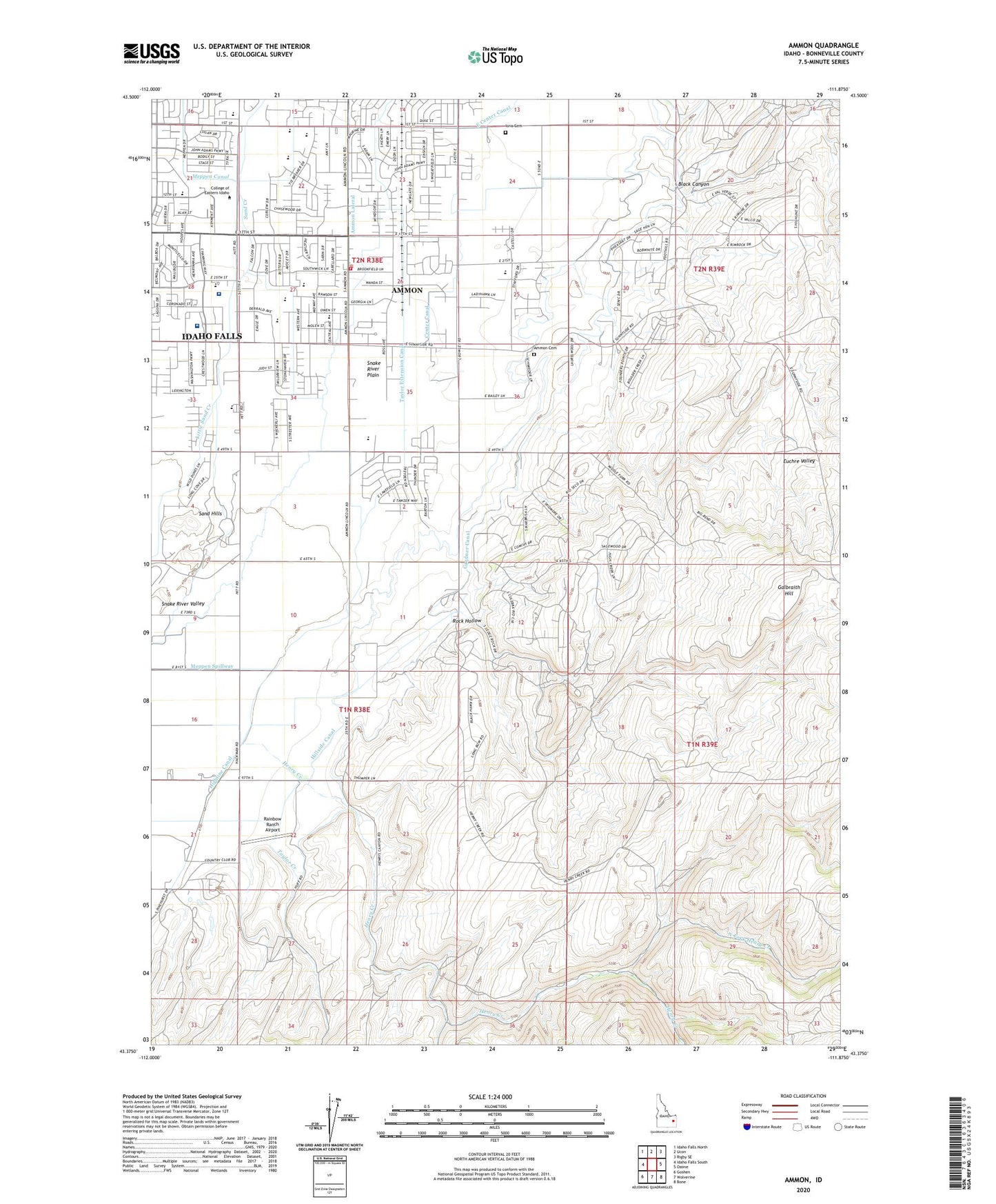
2024 topographic map quadrangle Ammon in the state of Idaho. Scale: 1:24000. Based on the newly updated USGS 7.5' US Topo map series, this map is in the following counties: Bonneville. The map contains contour data, water features, and other items you are used to seeing on USGS maps, but also has updated roads and other features. This is the next generation of topographic maps. Printed on high-quality waterproof paper with UV fade-resistant inks.
Quads adjacent to this one:
West: Idaho Falls South
Northwest: Idaho Falls North
North: Ucon
Northeast: Rigby SE
East: Ozone
Southeast: Bone
South: Wolverine
Southwest: Goshen
This map covers the same area as the classic USGS quad with code o43111d8.
Contains the following named places: Ammon, Ammon Cemetery, Ammon Extension Canal, Ammon Fire Department, Ammon Intermediate School, Black Canyon, Center Canal, City of Ammon, Dewey School, Dry Fork, E I Regional Medical Center Heliport, Eastern Idaho Regional Behavioral Health Center, Eastern Idaho Regional Medical Center, Eastern Idaho Vocational Technical School, Euchre Valley, Falls Valley Elementary School, Family Emergency Center, Galbraith Hill, Grand Teton Mall, Hackman, Henry Creek, Henry Creek School, Highline Canal, Hillcrest High School, Hillside Canal, Hillview Primary School, Hope Lutheran School, Idaho Falls Division, Iona Cemetery, McCowin Park, Meppen Spillway, Mountain View Hospital, North Fork Henry Creek, Pleasant View School, Rainbow Ranch Airport, Rock Hollow, Sandcreek Middle School, Snake River Plain, Taylor Creek, Taylor Extension Canal, Tiebreaker Elementary School, Western Rehabilitation Institute