MyTopo
Ucon Idaho US Topo Map
Couldn't load pickup availability
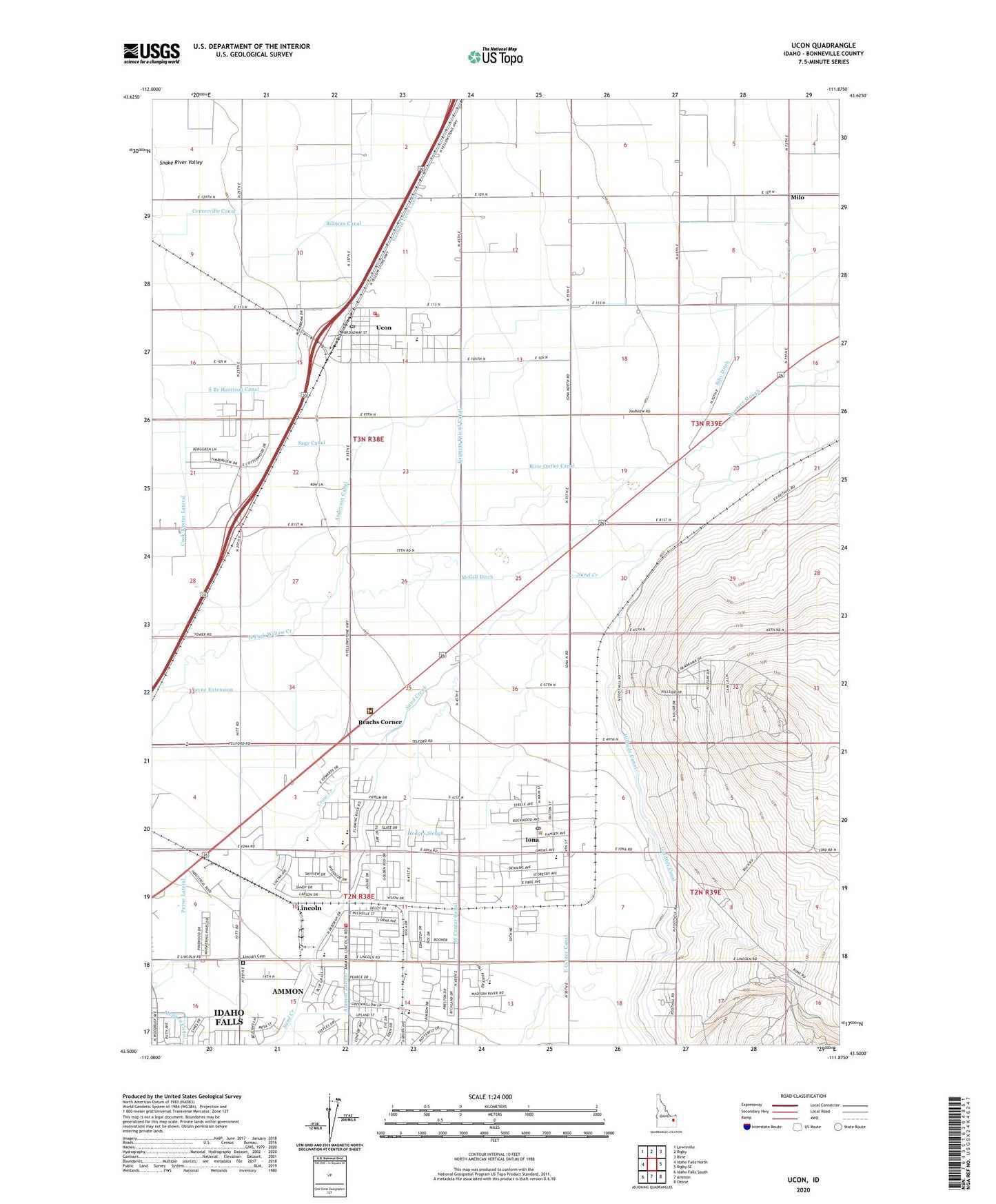
2024 topographic map quadrangle Ucon in the state of Idaho. Scale: 1:24000. Based on the newly updated USGS 7.5' US Topo map series, this map is in the following counties: Bonneville. The map contains contour data, water features, and other items you are used to seeing on USGS maps, but also has updated roads and other features. This is the next generation of topographic maps. Printed on high-quality waterproof paper with UV fade-resistant inks.
Quads adjacent to this one:
West: Idaho Falls North
Northwest: Lewisville
North: Rigby
Northeast: Ririe
East: Rigby SE
Southeast: Ozone
South: Ammon
Southwest: Idaho Falls South
This map covers the same area as the classic USGS quad with code o43111e8.
Contains the following named places: Ammon Lateral, Beachs Corner, Biby Ditch, Billman Canal, Bonneville High School, Boomer Slough, Centerville Canal, City of Iona, City of Ucon, Cloverdale Elementary School, East Center Canal, Gardner Canal, Hodges Slough, Idaho Falls Fire Department Station 2, Iona, Iona Elementary School, Iona Post Office, KFTZ-FM (Idaho Falls), KID-AM (Idaho Falls), KTEE-AM (Idaho Falls), KUPI-FM (Idaho Falls), Lincoln, Lincoln Cemetery, Lincoln Census Designated Place, Lincoln Elementary School, Little Sand Creek, McGill Ditch, Meppen Canal, Milo, Norton Ditch, Payne Extension, Payne Lateral, Ririe Outlet Canal, Rocky Mountain Middle School, Saint Leon School, Sand Creek, South Branch Harrison Canal, Ucon, Ucon Cemetery, Ucon Division, Ucon Elementary School, Ucon Post Office, Ucon Volunteer Fire Department, West Center Canal, Willow Creek, ZIP Codes: 83401, 83427, 83454