MyTopo
Bone Idaho US Topo Map
Couldn't load pickup availability
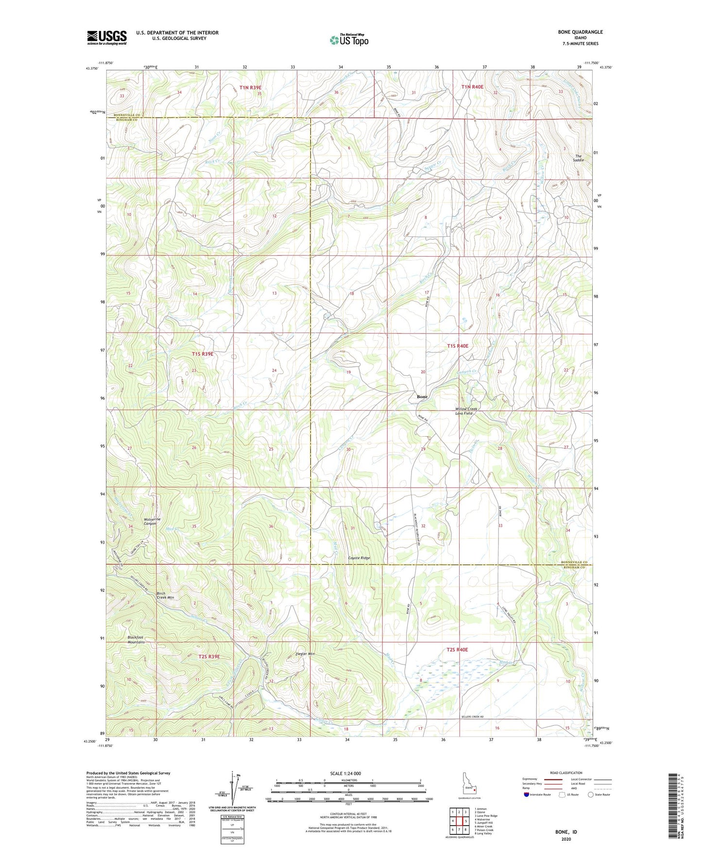
2023 topographic map quadrangle Bone in the state of Idaho. Scale: 1:24000. Based on the newly updated USGS 7.5' US Topo map series, this map is in the following counties: Bingham, Bonneville. The map contains contour data, water features, and other items you are used to seeing on USGS maps, but also has updated roads and other features. This is the next generation of topographic maps. Printed on high-quality waterproof paper with UV fade-resistant inks.
Quads adjacent to this one:
West: Wolverine
Northwest: Ammon
North: Ozone
Northeast: Lone Pine Ridge
East: Jumpoff Hill
Southeast: Long Valley
South: Poison Creek
Southwest: Miner Creek
This map covers the same area as the classic USGS quad with code o43111c7.
Contains the following named places: Birch Creek, Birch Creek Dam, Birch Creek Mountain, Bohn Dam, Bone, Bone Post Office, Canyon Creek, Coyote Ridge, Double W Divide, Grays Lake Outlet, Mud Creek, Rock Creek School, Sellars Creek, South Fork Sellars Creek, Squaw Creek, The Saddle, Twin Creek, Ziegler Mountain