MyTopo
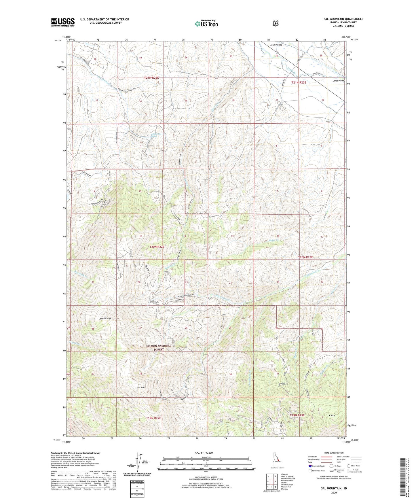
Sal Mountain Idaho US Topo Map
Couldn't load pickup availability
Also explore the Sal Mountain Forest Service Topo of this same quad for updated USFS data
2024 topographic map quadrangle Sal Mountain in the state of Idaho. Scale: 1:24000. Based on the newly updated USGS 7.5' US Topo map series, this map is in the following counties: Lemhi. The map contains contour data, water features, and other items you are used to seeing on USGS maps, but also has updated roads and other features. This is the next generation of topographic maps. Printed on high-quality waterproof paper with UV fade-resistant inks.
Quads adjacent to this one:
West: Williams Lake
Northwest: Salmon
North: East of Salmon
Northeast: Bohannon Spring
East: Baker
Southeast: Tendoy
South: Poison Peak
Southwest: Goldbug Ridge
This map covers the same area as the classic USGS quad with code o45113a7.
Contains the following named places: Cheney Creek, Harmony Mine, Hot Spring Creek, Joe Moore Creek, K Mountain, Mulkey Creek, Pope Shenon Mine, Sal Mountain, Salmon Hot Spring