MyTopo
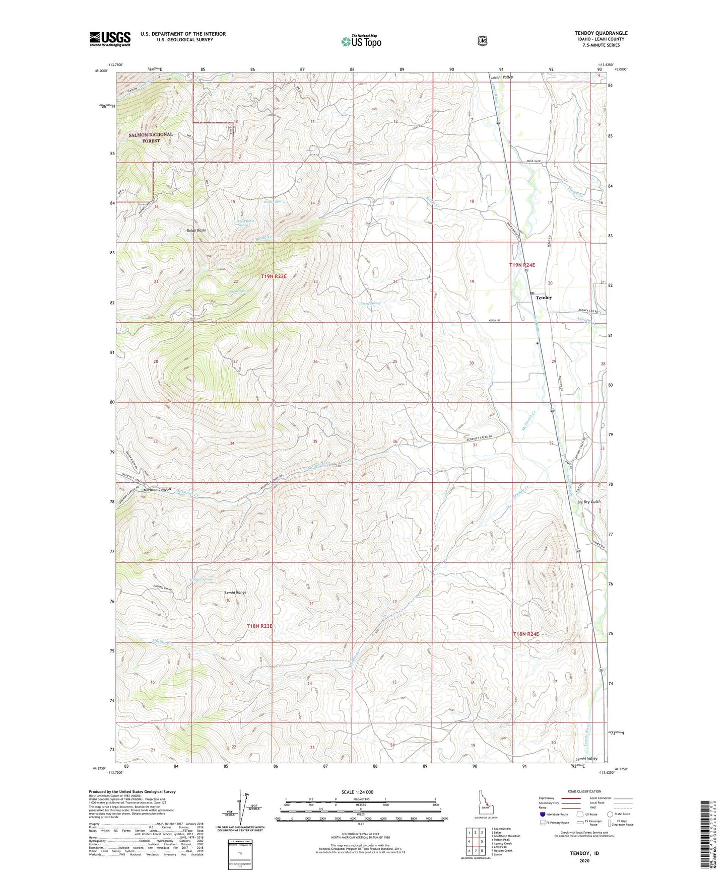
Tendoy Idaho US Topo Map
Couldn't load pickup availability
Also explore the Tendoy Forest Service Topo of this same quad for updated USFS data
2023 topographic map quadrangle Tendoy in the state of Idaho. Scale: 1:24000. Based on the newly updated USGS 7.5' US Topo map series, this map is in the following counties: Lemhi. The map contains contour data, water features, and other items you are used to seeing on USGS maps, but also has updated roads and other features. This is the next generation of topographic maps. Printed on high-quality waterproof paper with UV fade-resistant inks.
Quads adjacent to this one:
West: Poison Peak
Northwest: Sal Mountain
North: Baker
Northeast: Goldstone Mountain
East: Agency Creek
Southeast: Lemhi
South: Hayden Creek
Southwest: Lem Peak
This map covers the same area as the classic USGS quad with code o44113h6.
Contains the following named places: Agency Creek, Baldy Basin, Baldy Creek, Big Dry Gulch, Cherry Spring, First Basin Spring, Fort Lemhi, Fort Lemhi Cemetery, Fort Lemhi Monument, Hodges Spring, Lemhi River Access Area, McDevitt Creek, Mormon Canyon, Muddy Creek, Pattee Creek, Rigger Spring, Sacajawea Monument, Smith Spring, Tendoy, Tendoy Elementary School, Tendoy Post Office