
MyTopo
Banida Idaho US Topo Map
Couldn't load pickup availability
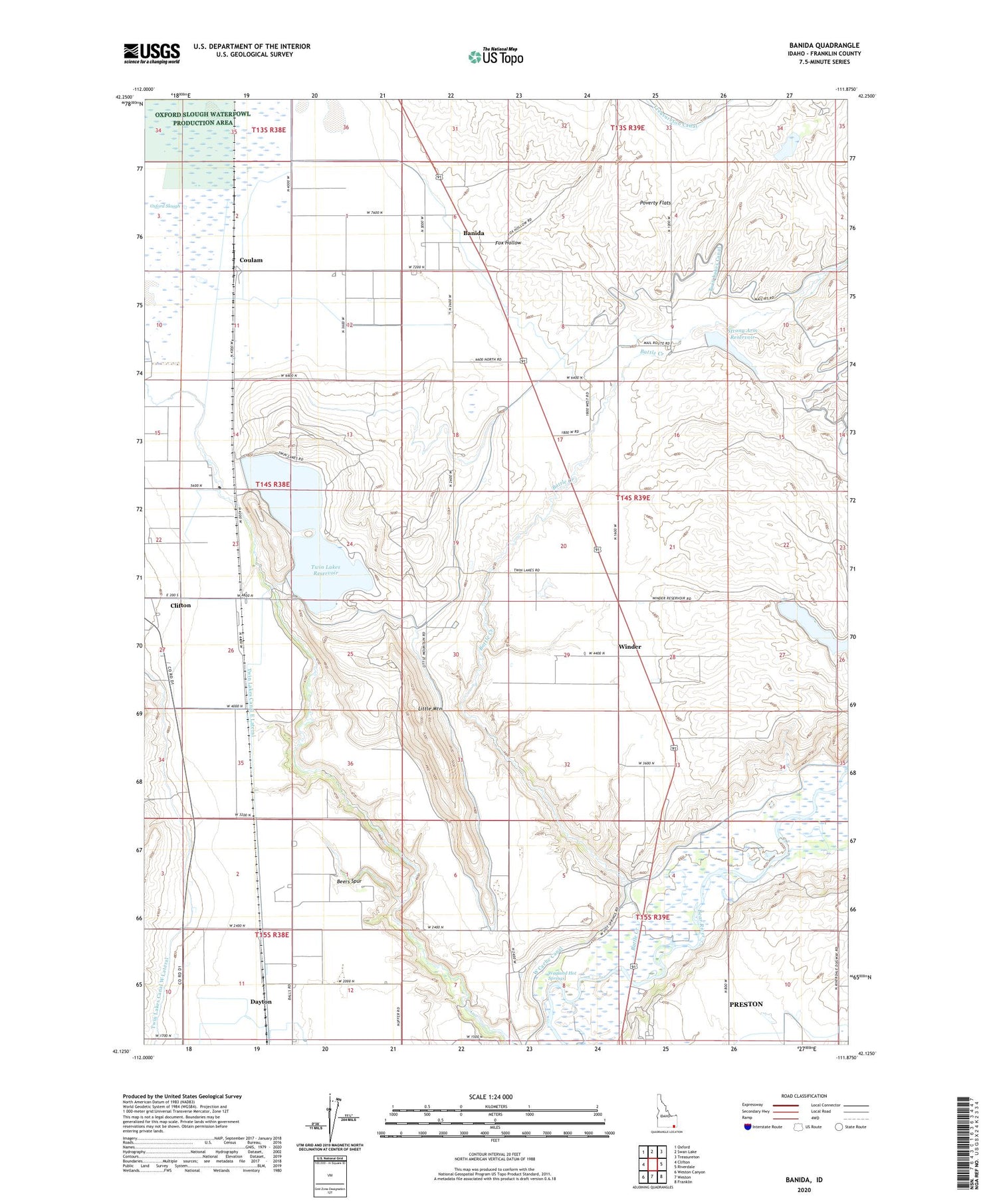
2024 topographic map quadrangle Banida in the state of Idaho. Scale: 1:24000. Based on the newly updated USGS 7.5' US Topo map series, this map is in the following counties: Franklin. The map contains contour data, water features, and other items you are used to seeing on USGS maps, but also has updated roads and other features. This is the next generation of topographic maps. Printed on high-quality waterproof paper with UV fade-resistant inks.
Quads adjacent to this one:
West: Clifton
Northwest: Oxford
North: Swan Lake
Northeast: Treasureton
East: Riverdale
Southeast: Franklin
South: Weston
Southwest: Weston Canyon
This map covers the same area as the classic USGS quad with code o42111b8.
Contains the following named places: Banida, Battle Creek, Beers Spur, Casperson Dam, Coulam, Dayton Siding, Fox Hollow, Little Mountain, Oxford Slough, Pioneer Women Historical Monument, Poverty Flats, Strong Arm Reservoir, Strongarm Reservoir Number Two Dam, Twin Lakes Access Area, Twin Lakes Canal East Lateral, Twin Lakes Northwest Dam, Twin Lakes Reservoir, Twin Lakes Southwest Dam, Wayland Hot Springs, Winder, Winder Dam, Winder Reservoir, ZIP Code: 83232


