MyTopo
Riverdale Idaho US Topo Map
Couldn't load pickup availability
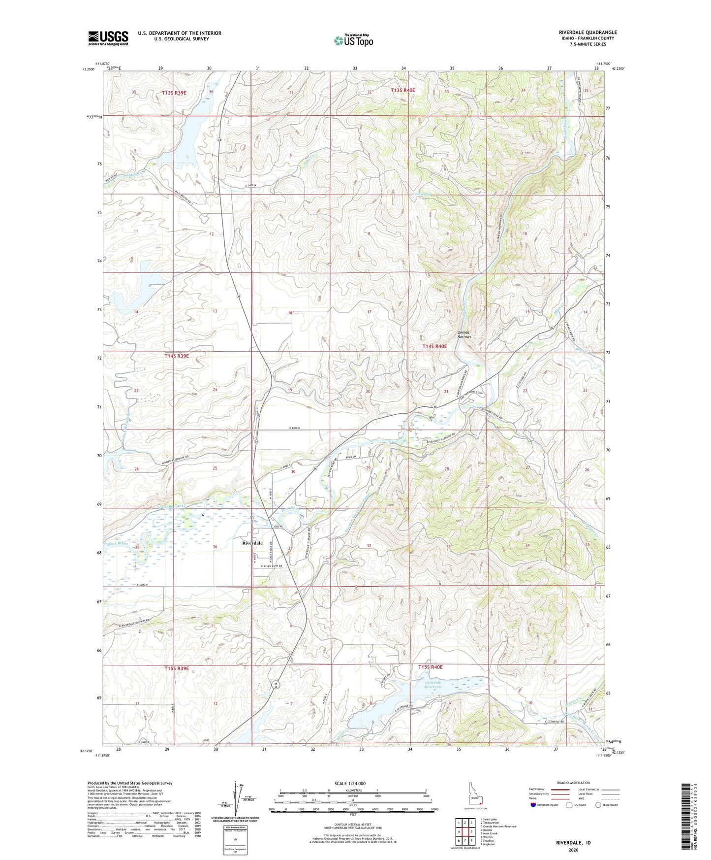
2024 topographic map quadrangle Riverdale in the state of Idaho. Scale: 1:24000. Based on the newly updated USGS 7.5' US Topo map series, this map is in the following counties: Franklin. The map contains contour data, water features, and other items you are used to seeing on USGS maps, but also has updated roads and other features. This is the next generation of topographic maps. Printed on high-quality waterproof paper with UV fade-resistant inks.
Quads adjacent to this one:
West: Banida
Northwest: Swan Lake
North: Treasureton
Northeast: Oneida Narrows Reservoir
East: Mink Creek
Southeast: Mapleton
South: Franklin
Southwest: Weston
This map covers the same area as the classic USGS quad with code o42111b7.
Contains the following named places: Bear Creek, Cold Spring, Condie Dam, Condie Reservoir, Falls, Foster Reservoir, Franklin County, Glendale Dam, Glendale Reservoir, Glendale Reservoir Access Area, KACH-AM (Preston), Mink Creek, Oneida Narrows, Preston Riverdale Canal, Riverdale, Sant Creek, Station Creek, Strongarm Reservoir Number One, Strongarm Reservoir Number One Dam, Treasureton Reservoir, Twin Lakes Canal, West Cache Canal, ZIP Code: 83263