
MyTopo
Blue Bunch Mountain Idaho US Topo Map
Couldn't load pickup availability
Also explore the Blue Bunch Mountain Forest Service Topo of this same quad for updated USFS data
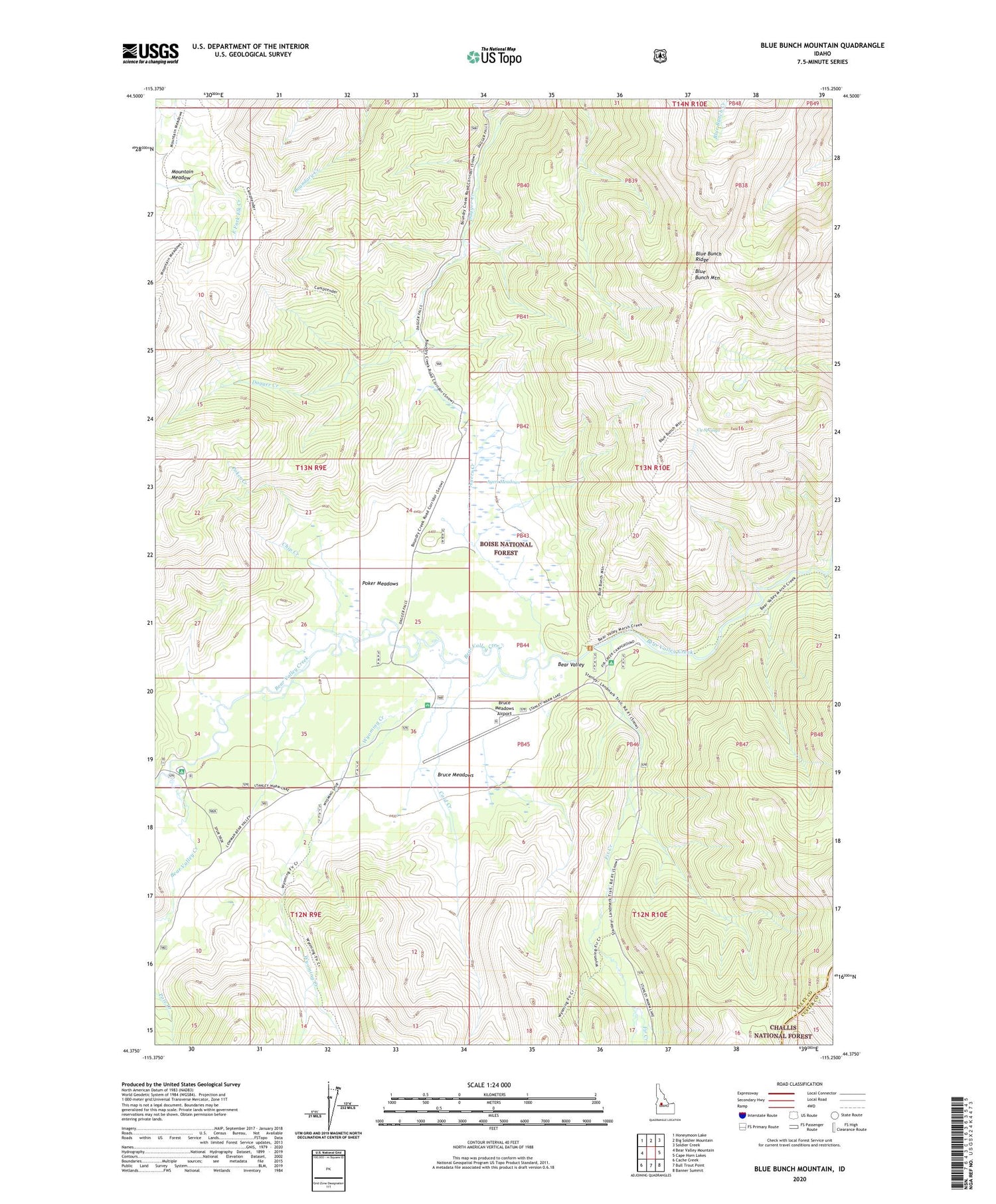
2024 topographic map quadrangle Blue Bunch Mountain in the state of Idaho. Scale: 1:24000. Based on the newly updated USGS 7.5' US Topo map series, this map is in the following counties: Valley, Custer. The map contains contour data, water features, and other items you are used to seeing on USGS maps, but also has updated roads and other features. This is the next generation of topographic maps. Printed on high-quality waterproof paper with UV fade-resistant inks.
Quads adjacent to this one:
West: Bear Valley Mountain
Northwest: Honeymoon Lake
North: Big Soldier Mountain
Northeast: Soldier Creek
East: Cape Horn Lakes
Southeast: Banner Summit
South: Bull Trout Point
Southwest: Cache Creek
This map covers the same area as the classic USGS quad with code o44115d3.
Contains the following named places: Ayers Creek, Ayers Meadows, Bear Valley, Bear Valley Campground, Bear Valley Creek Trail, Blue Bunch Mountain, Blue Bunch Ridge, Blue Bunch Trail, Bruce Meadows, Bruce Meadows Airport, Bruce Meadows Campground, Camptender Trail, Chip Creek, Cold Creek, Cy Springs, Elk Creek, Fir Creek, Fir Creek Campground, Mountain Meadow, Poker Creek, Poker Meadows, Poker Meadows Campground, Wyoming Creek


