MyTopo
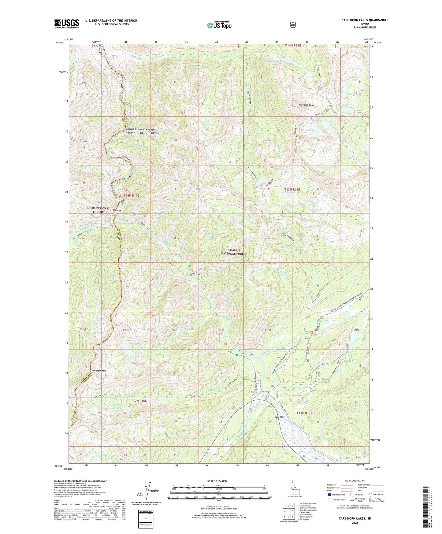
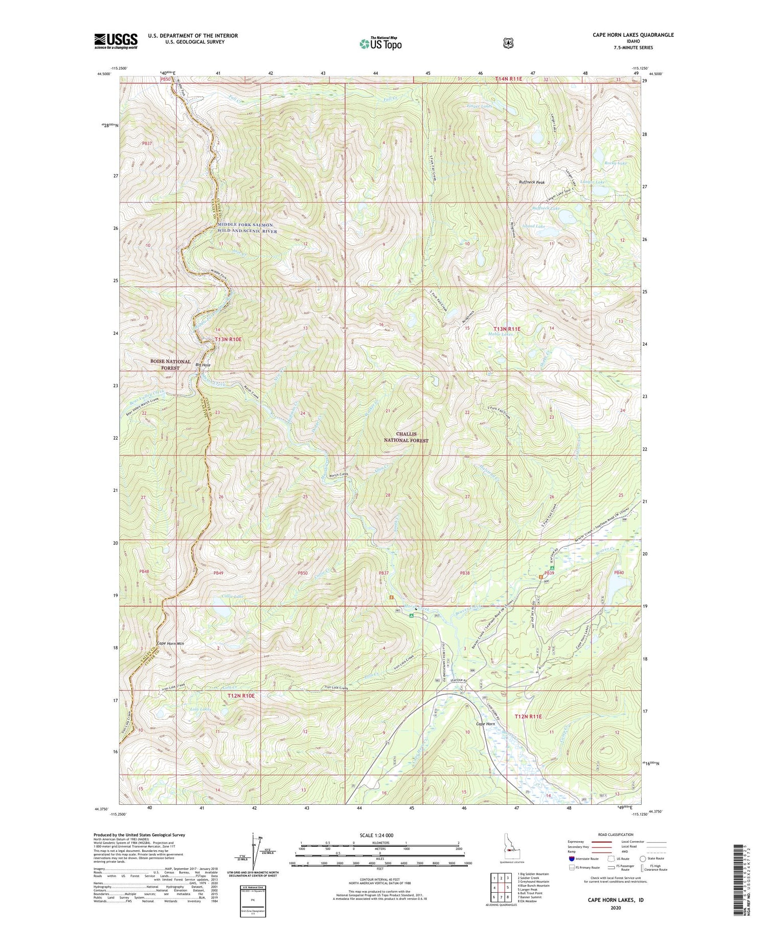
Cape Horn Lakes Idaho US Topo Map
Couldn't load pickup availability
Also explore the Cape Horn Lakes Forest Service Topo of this same quad for updated USFS data
2024 topographic map quadrangle Cape Horn Lakes in the state of Idaho. Scale: 1:24000. Based on the newly updated USGS 7.5' US Topo map series, this map is in the following counties: Custer, Valley. The map contains contour data, water features, and other items you are used to seeing on USGS maps, but also has updated roads and other features. This is the next generation of topographic maps. Printed on high-quality waterproof paper with UV fade-resistant inks.
Quads adjacent to this one:
West: Blue Bunch Mountain
Northwest: Big Soldier Mountain
North: Soldier Creek
Northeast: Greyhound Mountain
East: Langer Peak
Southeast: Elk Meadow
South: Banner Summit
Southwest: Bull Trout Point
This map covers the same area as the classic USGS quad with code o44115d2.
Contains the following named places: Allen Creek, Bear Valley Creek, Beaver Creek, Beaver Creek Campground, Big Hole, Bradley Memorial Camp, Camp Creek, Cape Horn, Cape Horn Creek, Cape Horn Lakes, Cape Horn Mountain, Collie Creek, Collie Lake, Dodge Creek, Fall Creek, Finger Lakes, Halstead Creek, Huffman Creek, Island Lake, Jose Creek, Laidlow Creek, Langer Lake, Lola Creek, Lola Creek Campground, Lola Lakes, Mable Lakes, Marsh Creek, Marsh Creek Recreation Site, Marsh Creek Transfer Camp, New Creek, Rocky Lake, Ruffneck Lake, Ruffneck Peak, Smith Creek, Walker Creek