MyTopo
Lone Pine Ridge Idaho US Topo Map
Couldn't load pickup availability
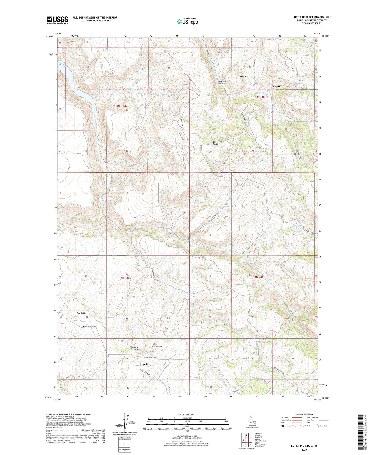
2024 topographic map quadrangle Lone Pine Ridge in the state of Idaho. Scale: 1:24000. Based on the newly updated USGS 7.5' US Topo map series, this map is in the following counties: Bonneville. The map contains contour data, water features, and other items you are used to seeing on USGS maps, but also has updated roads and other features. This is the next generation of topographic maps. Printed on high-quality waterproof paper with UV fade-resistant inks.
Quads adjacent to this one:
West: Ozone
Northwest: Rigby SE
North: Poplar
Northeast: Heise SE
East: Point Lookout
Southeast: Castle Rock
South: Jumpoff Hill
Southwest: Bone
This map covers the same area as the classic USGS quad with code o43111d6.
Contains the following named places: Bear Creek, Big Horse Butte, Blue Creek, Bulls Fork, Deer Creek, Dehlin, Dehlin Post Office, Dehlin School, Dogtooth Hollow, Guyaz, Indian Fork, Little Horse Butte, Lone Pine Ridge, Pipe Creek, Pipe Creek School, Red Butte, Skelly Hill, Spring Creek, Tex Creek, Tex Creek Wildlife Management Area