MyTopo
Border Idaho US Topo Map
Couldn't load pickup availability
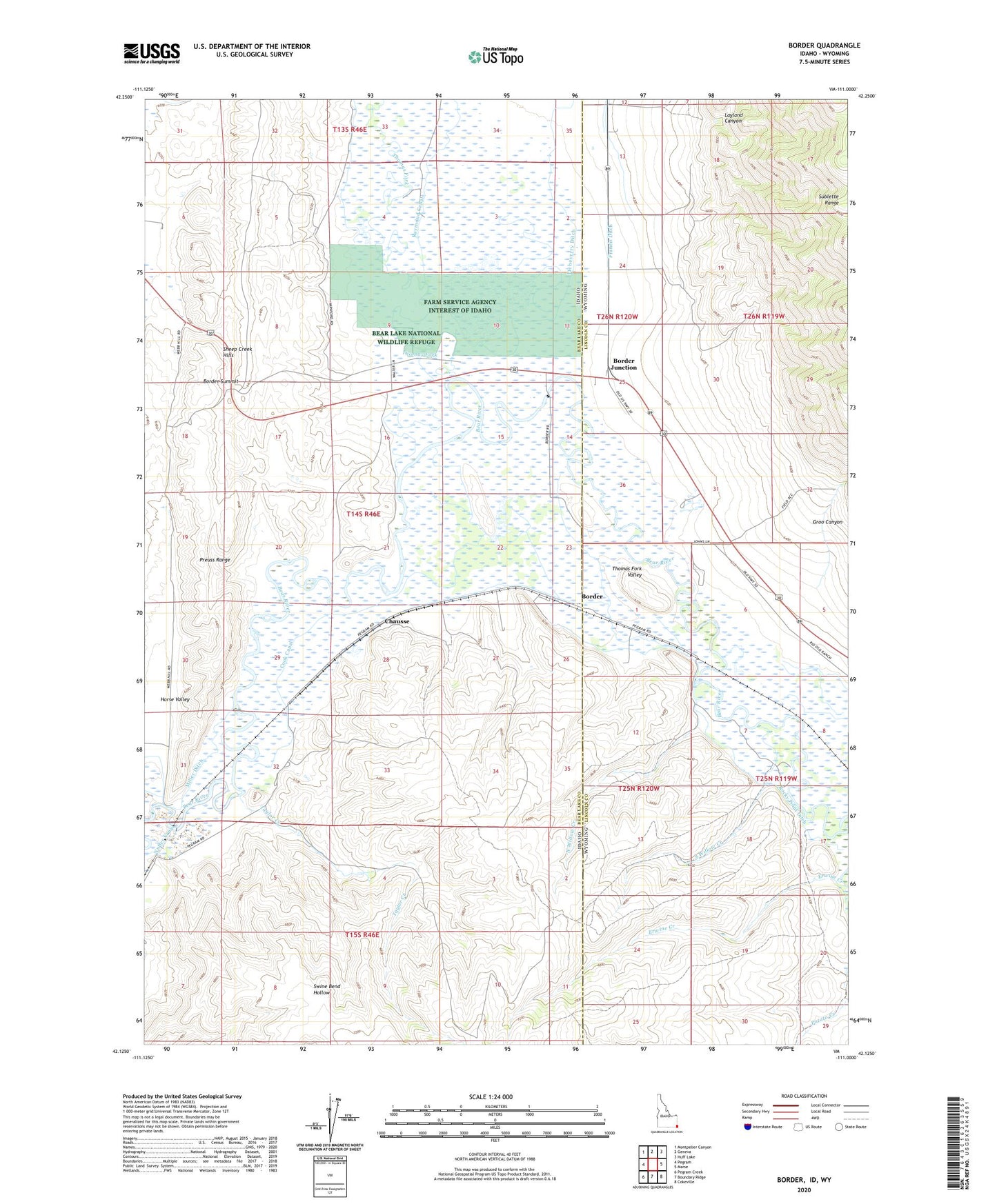
2023 topographic map quadrangle Border in the states of Idaho, Wyoming. Scale: 1:24000. Based on the newly updated USGS 7.5' US Topo map series, this map is in the following counties: Bear Lake, Lincoln. The map contains contour data, water features, and other items you are used to seeing on USGS maps, but also has updated roads and other features. This is the next generation of topographic maps. Printed on high-quality waterproof paper with UV fade-resistant inks.
Quads adjacent to this one:
West: Pegram
Northwest: Montpelier Canyon
North: Geneva
Northeast: Huff Lake
East: Marse
Southeast: Cokeville
South: Boundary Ridge
Southwest: Pegram Creek
Contains the following named places: Border, Border Junction, Border Summit, Chausse, Cook Canal, Erwine Creek, Etcheverry Ditch, Farm Service Agency Interest of Idaho, Francis Ditch, Groo Canyon, Horse Valley, Layland Canyon, Miller Ditch, North Willow Creek, Rocky Point Ditch, Sights Ditch, South Willow Creek, Taylor Creek, Thomas Fork, Thomas Fork Valley