MyTopo
Pegram Idaho US Topo Map
Couldn't load pickup availability
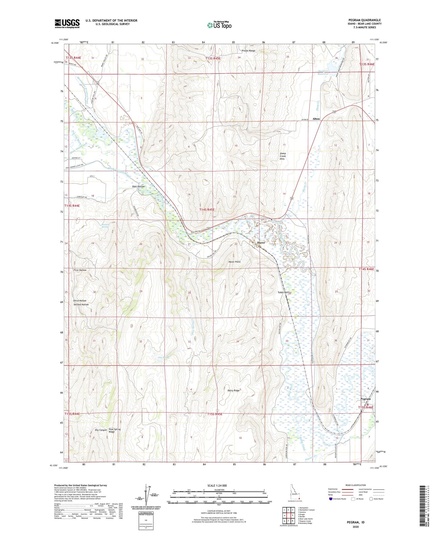
2023 topographic map quadrangle Pegram in the state of Idaho. Scale: 1:24000. Based on the newly updated USGS 7.5' US Topo map series, this map is in the following counties: Bear Lake. The map contains contour data, water features, and other items you are used to seeing on USGS maps, but also has updated roads and other features. This is the next generation of topographic maps. Printed on high-quality waterproof paper with UV fade-resistant inks.
Quads adjacent to this one:
West: Dingle
Northwest: Montpelier
North: Montpelier Canyon
Northeast: Geneva
East: Border
Southeast: Boundary Ridge
South: Pegram Creek
Southwest: Bear Lake North
This map covers the same area as the classic USGS quad with code o42111b2.
Contains the following named places: Alton, Bear Lake Volunteer Fire Protection District Station 6, Bennetts Grove, Bennetts Spring, Dairy Ridge, Dam Hollow, Dingle, First Hollow, Harer, Harer Point, Nuffer Canal, Peg Leg Ditch, Pegram, Pegram Creek, Pine Spring, Pine Spring Creek, Pine Spring Ridge, Second Hollow, Sheep Creek, Sheep Creek Dam, Sheep Creek Reservoir, Sugarloaf, Third Hollow, Tubbs Hollow, West Fork Sheep Creek, ZIP Code: 83233