
MyTopo
Boulder Chain Lakes Idaho US Topo Map
Couldn't load pickup availability
Also explore the Boulder Chain Lakes Forest Service Topo of this same quad for updated USFS data
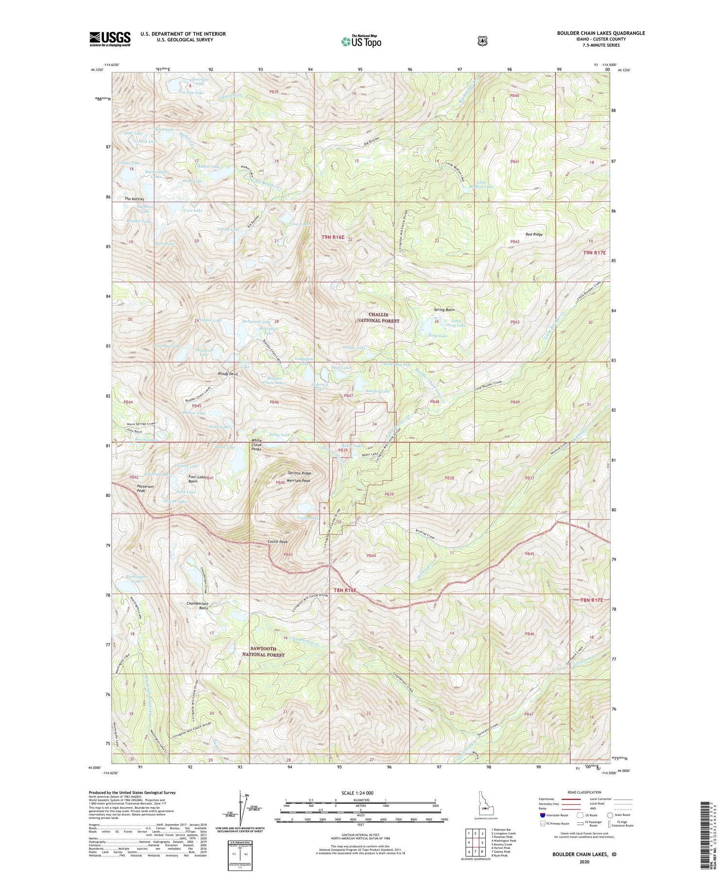
2024 topographic map quadrangle Boulder Chain Lakes in the state of Idaho. Scale: 1:24000. Based on the newly updated USGS 7.5' US Topo map series, this map is in the following counties: Custer. The map contains contour data, water features, and other items you are used to seeing on USGS maps, but also has updated roads and other features. This is the next generation of topographic maps. Printed on high-quality waterproof paper with UV fade-resistant inks.
Quads adjacent to this one:
West: Washington Peak
Northwest: Robinson Bar
North: Livingston Creek
Northeast: Potaman Peak
East: Bowery Creek
Southeast: Ryan Peak
South: Galena Peak
Southwest: Horton Peak
This map covers the same area as the classic USGS quad with code o44114a5.
Contains the following named places: Baker Lake, Big Boulder Lakes, Bighorn Creek, Boorn Lakes, Boulder Chain Lakes, Boulder Chain Lakes Creek, Boulder Lake, Castle Lake, Castle Peak, Chamberlain Basin, Chamberlain Creek, Cirque Lake, Cornice Lake, Cove Lake, Emerald Lake, Four Lakes Basin, Frog Lake, Frog Lakes, Gentian Lake, Glacier Lake, Goat Lake, Gunsight Creek, Hatchet Lake, Headwall Lake, Hidden Lake, Hook Lake, Hourglass Lake, Hummock Lake, Island Lake, Little Frog Lake, Little Redfish Lake, Lodgepole Lake, Lonesome Lake, Merriam Peak, Neck Lake, Noisy Lake, Patterson Peak, Quartzite Lake, Quiet Lake, Red Ridge, Rock Lake, Sapphire Lake, Scoop Lake, Scree Lake, Serrate Ridge, Shallow Lake, Sheep Lake, Shelf Lake, Slickenside Creek, Slide Lake, Sliderock Lake, Snow Lake, Spring Basin, The Kettles, Tin Cup Lake, Tiny Lake, Walker Lake, Washington Lake, Waterdog Lake, White Cloud Peaks, Willow Lake, Windy Devil


