MyTopo
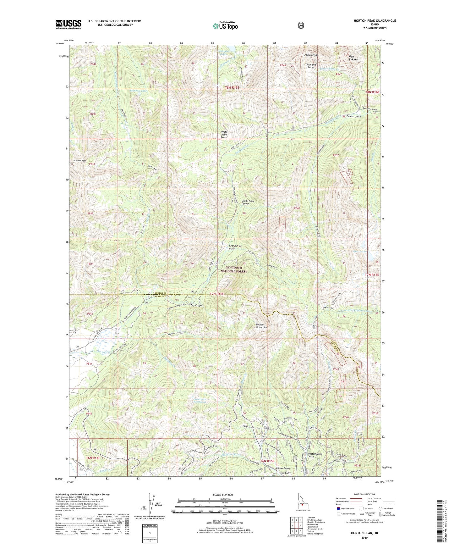
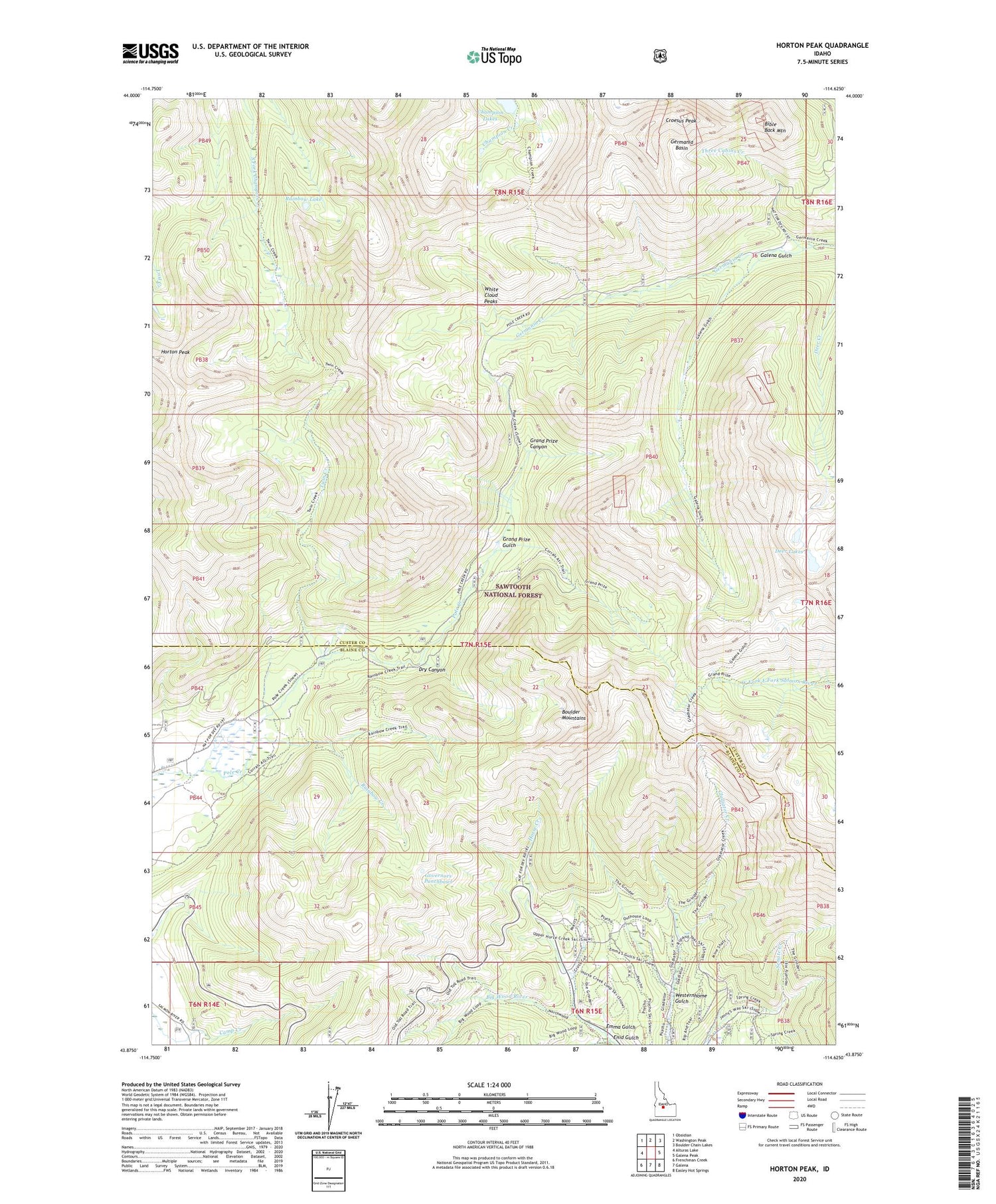
Horton Peak Idaho US Topo Map
Couldn't load pickup availability
Also explore the Horton Peak Forest Service Topo of this same quad for updated USFS data
2024 topographic map quadrangle Horton Peak in the state of Idaho. Scale: 1:24000. Based on the newly updated USGS 7.5' US Topo map series, this map is in the following counties: Custer, Blaine. The map contains contour data, water features, and other items you are used to seeing on USGS maps, but also has updated roads and other features. This is the next generation of topographic maps. Printed on high-quality waterproof paper with UV fade-resistant inks.
Quads adjacent to this one:
West: Alturas Lake
Northwest: Obsidian
North: Washington Peak
Northeast: Boulder Chain Lakes
East: Galena Peak
Southeast: Easley Hot Springs
South: Galena
Southwest: Frenchman Creek
This map covers the same area as the classic USGS quad with code o43114h6.
Contains the following named places: Bible Back Mountain, Champion Lakes, Croesus Peak, Deer Lakes, Dry Canyon, Emma Gulch, Enid Gulch, Galena Gulch, Germania Basin, Governors Punchbowl, Grand Prize Canyon, Grand Prize Gulch, Horse Creek, Horton Peak, Pole Creek Guard Station, Rainbow Creek, Rainbow Lake, Three Cabins Creek, Twin Creek, Westernhome Gulch