MyTopo
Bruneau Idaho US Topo Map
Couldn't load pickup availability
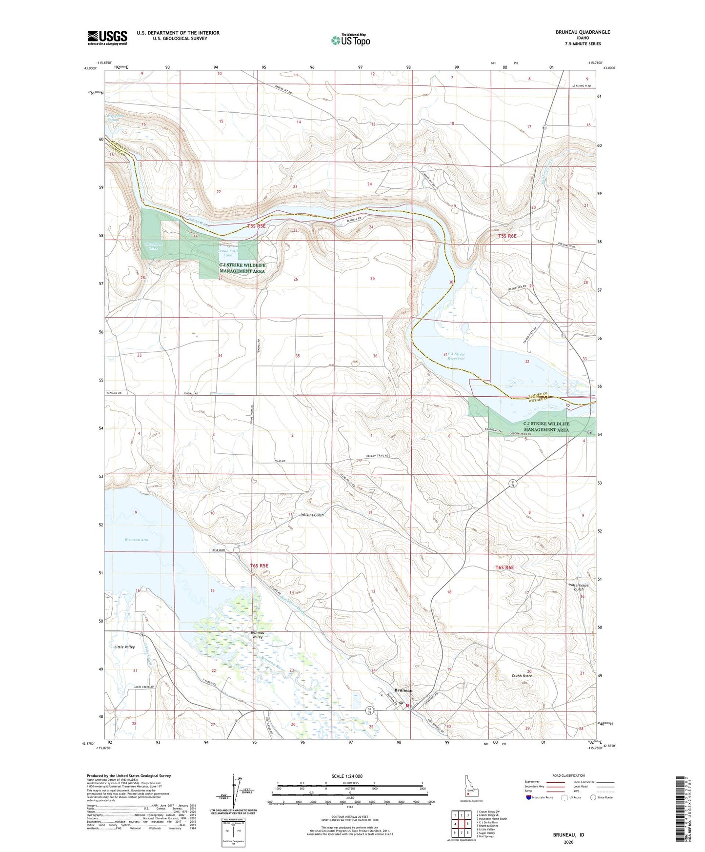
2024 topographic map quadrangle Bruneau in the state of Idaho. Scale: 1:24000. Based on the newly updated USGS 7.5' US Topo map series, this map is in the following counties: Owyhee, Elmore. The map contains contour data, water features, and other items you are used to seeing on USGS maps, but also has updated roads and other features. This is the next generation of topographic maps. Printed on high-quality waterproof paper with UV fade-resistant inks.
Quads adjacent to this one:
West: C J Strike Dam
Northwest: Crater Rings SW
North: Crater Rings SE
Northeast: Mountain Home South
East: Bruneau Dunes
Southeast: Hot Springs
South: Sugar Valley
Southwest: Little Valley
This map covers the same area as the classic USGS quad with code o42115h7.
Contains the following named places: Bruneau, Bruneau Arm, Bruneau Census Designated Place, Bruneau Elementary School, Bruneau Fire Department, Bruneau Guard Station, Bruneau Post Office, Cove Arm Lake, Crabb Butte, Crane Falls, Crane Falls Lake, Edgington Island, Emigrant Crossing, Indian Cove Wildlife Habitat Area, Jacks Creek, Little Valley, Little Valley School, Loveridge Bridge, Loveridge Bridge Access Area, Loveridge Island, Rattlesnake Creek, South Side Canal, Sugar Valley Wash, Tyrrel Island, Waterhouse Gulch, Weatherby Springs, Wilkins Gulch, Young Landing Area