MyTopo
Crater Rings SE Idaho US Topo Map
Couldn't load pickup availability
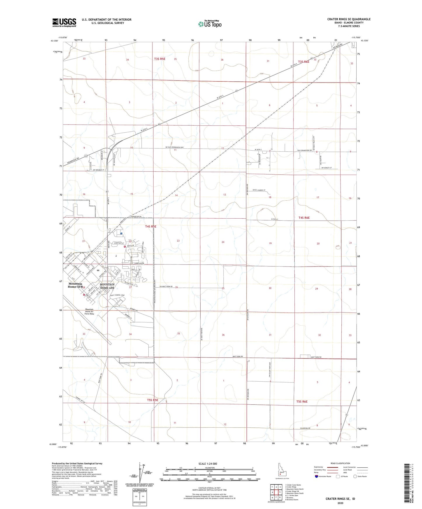
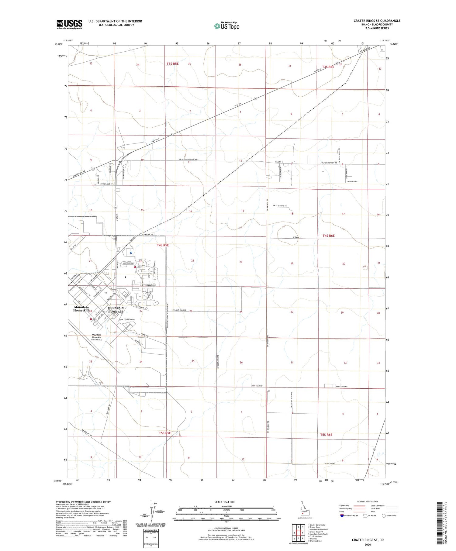
2023 topographic map quadrangle Crater Rings SE in the state of Idaho. Scale: 1:24000. Based on the newly updated USGS 7.5' US Topo map series, this map is in the following counties: Elmore. The map contains contour data, water features, and other items you are used to seeing on USGS maps, but also has updated roads and other features. This is the next generation of topographic maps. Printed on high-quality waterproof paper with UV fade-resistant inks.
Quads adjacent to this one:
West: Crater Rings SW
Northwest: Cinder Cone Butte
North: Crater Rings
Northeast: Mountain Home North
East: Mountain Home South
Southeast: Bruneau Dunes
South: Bruneau
Southwest: C J Strike Dam
This map covers the same area as the classic USGS quad with code o43115a7.
Contains the following named places: 366th Medical Group Hospital - Mountain Home Air Force Base, 83648, Mountain Home Air Force Base, Mountain Home Air Force Base Census Designated Place, Mountain Home Air Force Base Fire Department Station 1, Mountain Home Air Force Base Fire Department Station 2, Mountain Home Air Force Base Intermediate School, Mountain Home Air Force Base Junior High School, Mountain Home Air Force Base Post Office, Mountain Home Air Force Base Primary School