
MyTopo
Bumblebee Peak Idaho US Topo Map
Couldn't load pickup availability
Also explore the Bumblebee Peak Forest Service Topo of this same quad for updated USFS data
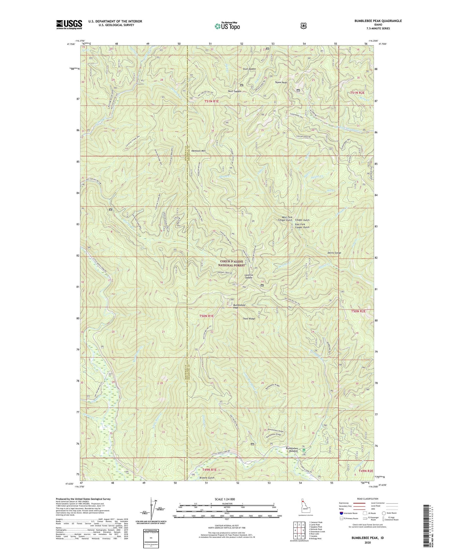
2024 topographic map quadrangle Bumblebee Peak in the state of Idaho. Scale: 1:24000. Based on the newly updated USGS 7.5' US Topo map series, this map is in the following counties: Shoshone, Kootenai. The map contains contour data, water features, and other items you are used to seeing on USGS maps, but also has updated roads and other features. This is the next generation of topographic maps. Printed on high-quality waterproof paper with UV fade-resistant inks.
Quads adjacent to this one:
West: Skitwish Peak
Northwest: Cataract Peak
North: Lamb Peak
Northeast: Spyglass Peak
East: Steamboat Creek
Southeast: Kellogg West
South: Cataldo
Southwest: Rose Lake
This map covers the same area as the classic USGS quad with code o47116f3.
Contains the following named places: Breakwater Campground, Breakwater Creek, Browns Gulch, Bumblebee Campground, Bumblebee Creek, Bumblebee Meadow, Bumblebee Peak, Coffin Creek, Colorado Creek, Copper Creek, County Creek, Devils Gorge, Dismal Creek, East Fork Cougar Gulch, Gimlet Creek, Halifax Creek, Hearse Creek, Hell Creek, Hemlock Creek, Hemlock Mountain, Hill Creek, Hull Creek, Laverne Saddle, Lavin Creek, Little Bumblebee Creek, Lone Creek, October Creek, Shell Ridge, Skull Saddle, Steep Creek, Stull Saddle, Tepee Peak, Tie Creek, West Fork Cougar Gulch


