MyTopo
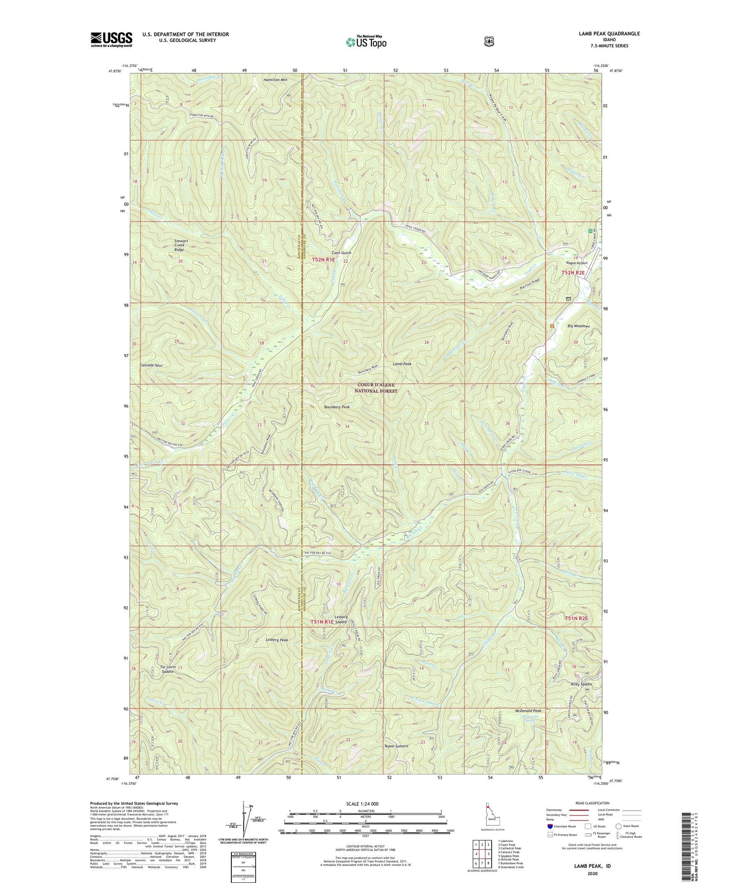
Lamb Peak Idaho US Topo Map
Couldn't load pickup availability
Also explore the Lamb Peak Forest Service Topo of this same quad for updated USFS data
2024 topographic map quadrangle Lamb Peak in the state of Idaho. Scale: 1:24000. Based on the newly updated USGS 7.5' US Topo map series, this map is in the following counties: Shoshone, Kootenai. The map contains contour data, water features, and other items you are used to seeing on USGS maps, but also has updated roads and other features. This is the next generation of topographic maps. Printed on high-quality waterproof paper with UV fade-resistant inks.
Quads adjacent to this one:
West: Cataract Peak
Northwest: Lakeview
North: Faset Peak
Northeast: Cathedral Peak
East: Spyglass Peak
Southeast: Steamboat Creek
South: Bumblebee Peak
Southwest: Skitwish Peak
This map covers the same area as the classic USGS quad with code o47116g3.
Contains the following named places: Bear Creek, Big Elk Creek, Big Gene Creek, Big Meadows, Boundary Creek, Boundary Peak, Boundary Peak Trail, Callis Creek, Coon Gulch, Dresser Creek, Drexall Creek, Erickson Ranch, First Creek, Halsey Creek, Hamilton Creek, Hump Creek, Lamb Peak, Leiberg Peak, Leiberg Saddle, Little Elk Creek, Magee Airport, Magee Historic Site, Mann Creek, McDonald Peak, McDonald Spring, McGee Ranger Station, New Creek, North Fork Callis Creek, Porcupine Creek, Potter Creek, Riley Creek, Riley Saddle, Ryan Creek, Second Creek, Short Creek, South Fork Potter Creek, Stewart Creek, Stull Creek, Tepee Summit, Third Creek, Tie Lavin Saddle, Trail Creek Work Center, U S Creek, Van Hoosier Creek, West Bear Creek, West Fork Tepee Creek, Y Creek