MyTopo
Skitwish Peak Idaho US Topo Map
Couldn't load pickup availability
Also explore the Skitwish Peak Forest Service Topo of this same quad for updated USFS data
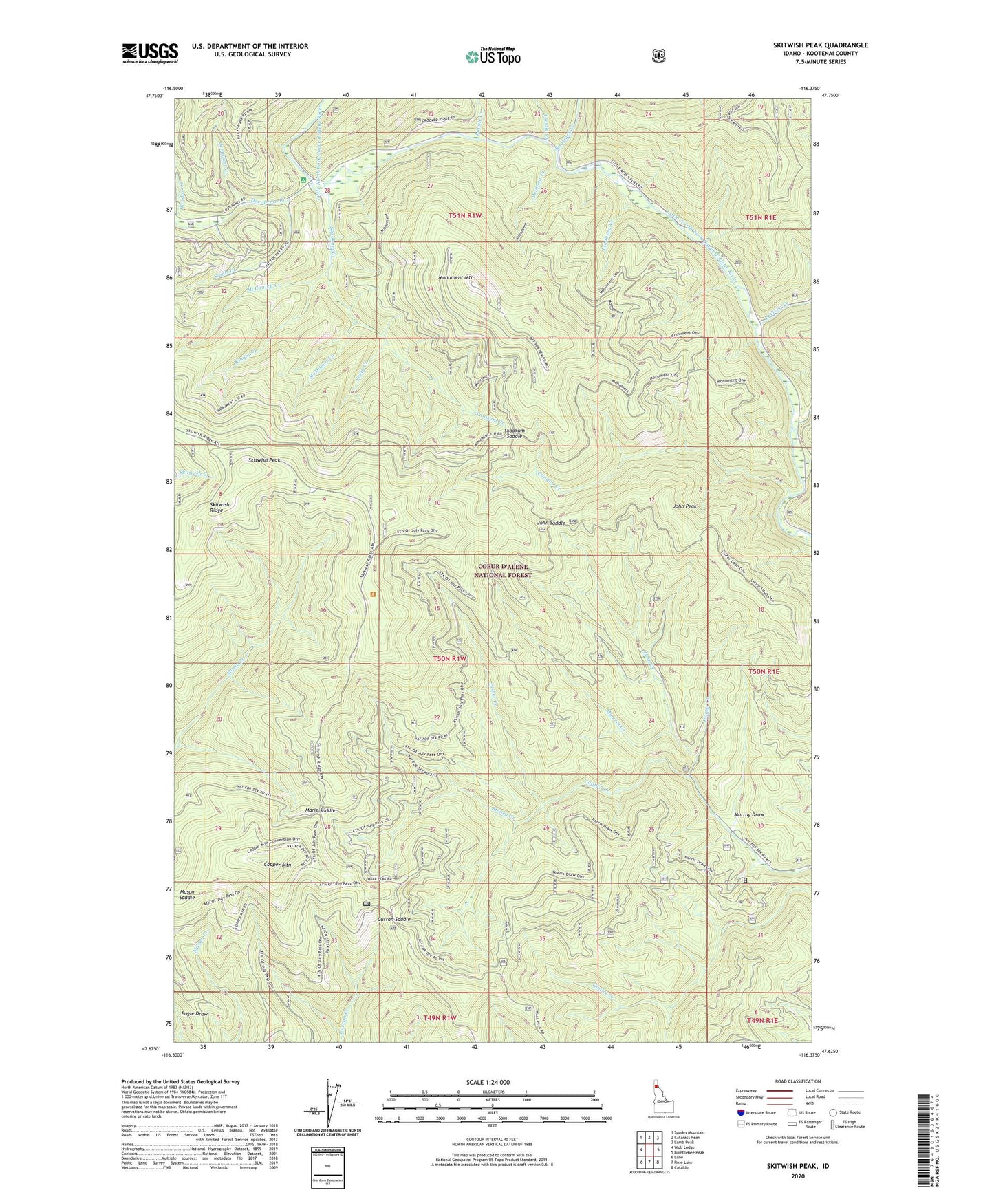
2024 topographic map quadrangle Skitwish Peak in the state of Idaho. Scale: 1:24000. Based on the newly updated USGS 7.5' US Topo map series, this map is in the following counties: Kootenai. The map contains contour data, water features, and other items you are used to seeing on USGS maps, but also has updated roads and other features. This is the next generation of topographic maps. Printed on high-quality waterproof paper with UV fade-resistant inks.
Quads adjacent to this one:
West: Wolf Lodge
Northwest: Spades Mountain
North: Cataract Peak
Northeast: Lamb Peak
East: Bumblebee Peak
Southeast: Cataldo
South: Rose Lake
Southwest: Lane
This map covers the same area as the classic USGS quad with code o47116f4.
Contains the following named places: Ames Creek, Bootjack Creek, Canyon Creek, Copper Mountain, Curran Saddle, Deception Creek, Delaney Creek, Demorest Creek, Early Creek, Fisher Creek, Homer Creek, Honeysuckle Campground, Hoodoo Creek, John Creek, John Peak, John Saddle, Knight Creek, Laverne Creek, Lavoie Creek, Leiberg Creek, Lindberg Creek, Marie Saddle, Mason Saddle, McCauley Creek, McMahon Creek, Mineral Creek, Monument Mountain, Murray Draw, Sands Creek, Skitwish Peak, Skitwish Ridge, Skookum Creek, Skookum Saddle, Stoney Creek, Trestle Creek