MyTopo
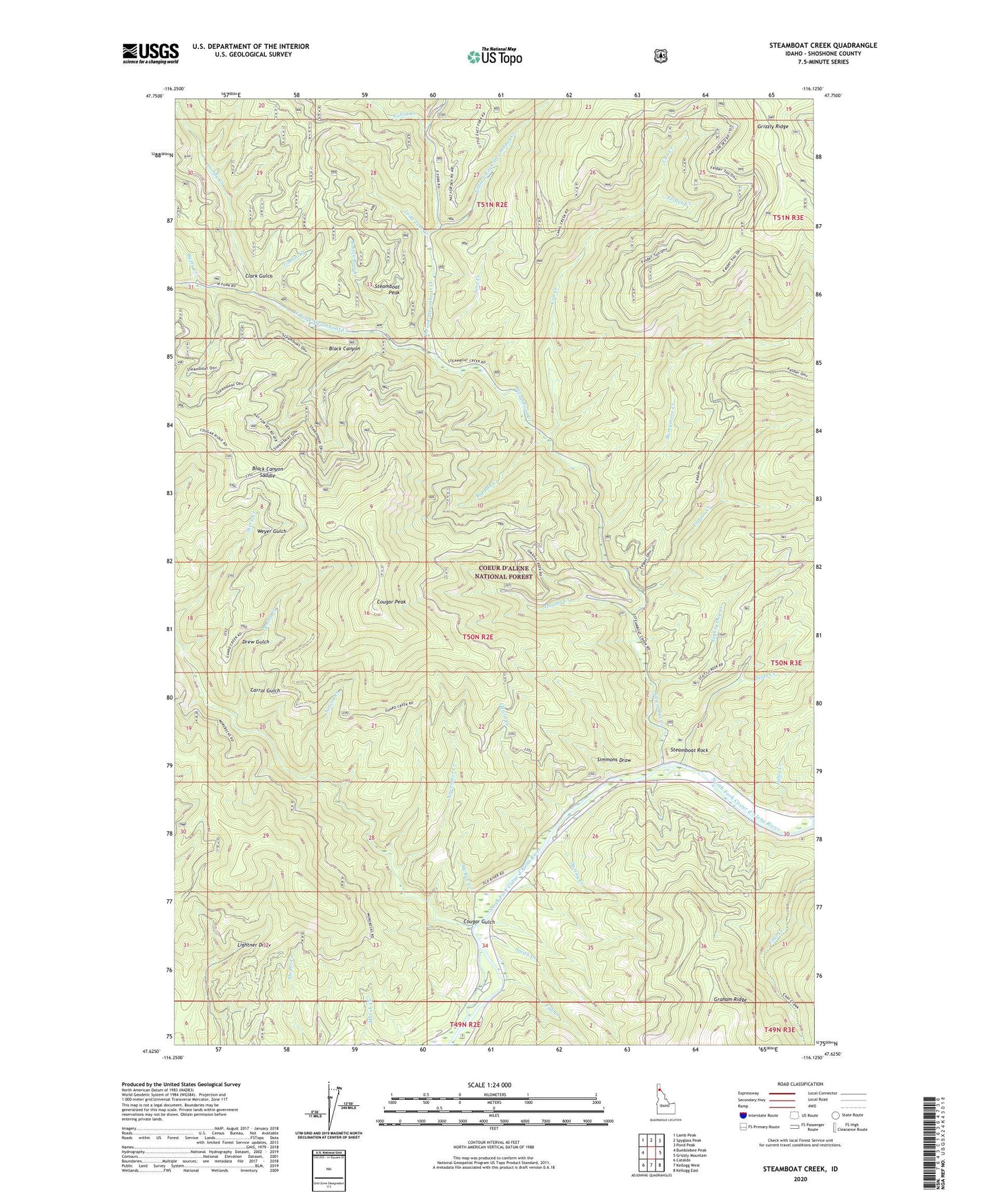
Steamboat Creek Idaho US Topo Map
Couldn't load pickup availability
Also explore the Steamboat Creek Forest Service Topo of this same quad for updated USFS data
2024 topographic map quadrangle Steamboat Creek in the state of Idaho. Scale: 1:24000. Based on the newly updated USGS 7.5' US Topo map series, this map is in the following counties: Shoshone. The map contains contour data, water features, and other items you are used to seeing on USGS maps, but also has updated roads and other features. This is the next generation of topographic maps. Printed on high-quality waterproof paper with UV fade-resistant inks.
Quads adjacent to this one:
West: Bumblebee Peak
Northwest: Lamb Peak
North: Spyglass Peak
Northeast: Pond Peak
East: Grizzly Mountain
Southeast: Kellogg East
South: Kellogg West
Southwest: Cataldo
This map covers the same area as the classic USGS quad with code o47116f2.
Contains the following named places: Barrymore Creek, Betty Creek, Big Bob Creek, Black Canyon, Black Canyon Saddle, Boston Brook, Cabin Creek, Can Creek, Carrol Gulch, Clark Gulch, Coeur d'Alene National Forest, Comfy Creek, Cougar Gulch, Cougar Peak, Dennis Creek, Drew Gulch, East Fork Steamboat Creek, Eighty Day Creek, Fall Creek, Felder Creek, Guard Creek, Indian Creek, June Creek, Little East Fork Steamboat Creek, Long Tom Creek, McRae Creek, Nelson Creek, November Creek, Omaha Creek, Pablo Creek, Scott Creek, Simmons Draw, Smith Creek, Spring Creek, Steamboat, Steamboat Camp, Steamboat Creek, Steamboat Peak, Steamboat Rock, Timber Creek, West Fork Steamboat Creek, Weyer Gulch