
MyTopo
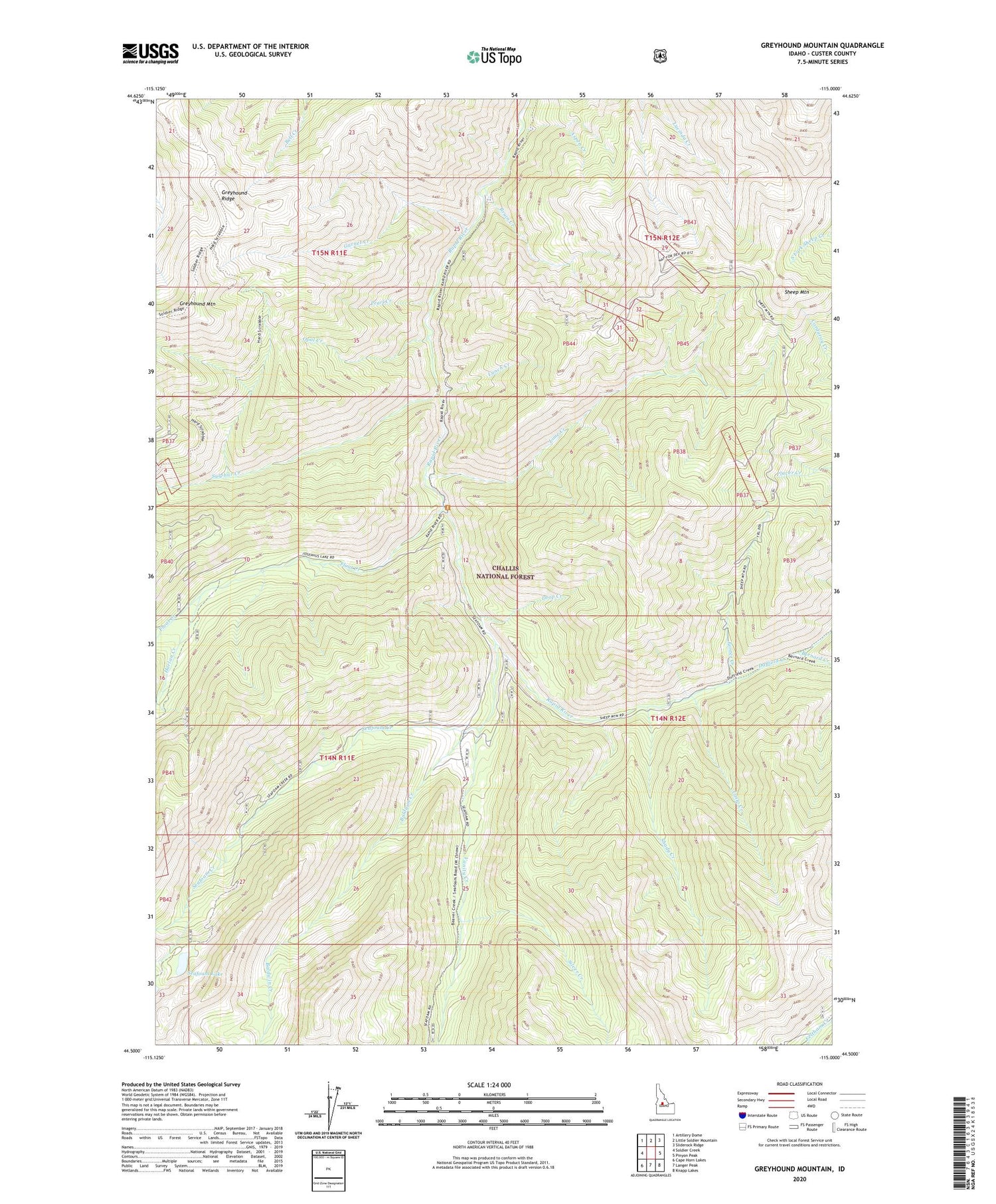
Greyhound Mountain Idaho US Topo Map
Couldn't load pickup availability
Also explore the Greyhound Mountain Forest Service Topo of this same quad for updated USFS data
2024 topographic map quadrangle Greyhound Mountain in the state of Idaho. Scale: 1:24000. Based on the newly updated USGS 7.5' US Topo map series, this map is in the following counties: Custer. The map contains contour data, water features, and other items you are used to seeing on USGS maps, but also has updated roads and other features. This is the next generation of topographic maps. Printed on high-quality waterproof paper with UV fade-resistant inks.
Quads adjacent to this one:
West: Soldier Creek
Northwest: Artillery Dome
North: Little Soldier Mountain
Northeast: Sliderock Ridge
East: Pinyon Peak
Southeast: Knapp Lakes
South: Langer Peak
Southwest: Cape Horn Lakes
This map covers the same area as the classic USGS quad with code o44115e1.
Contains the following named places: Aspen Creek, Baldwin Creek, Bernard Creek, Bruin Creek, Casto Creek, Drop Creek, Duffield Creek, Float Creek, Fontez Creek, Garnet Creek, Greyhound Mountain, Harlan Creek, Lime Creek, Lunch Creek, Mountain King Mine, Opal Creek, Pearl Creek, Seafoam Creek, Seafoam Guard Station, Seafoam Lake, Shady Creek, Sheep Mountain, Sheep Mountain Recreation Site, Silver Creek, Sulphur Creek, Vanity Creek


