MyTopo
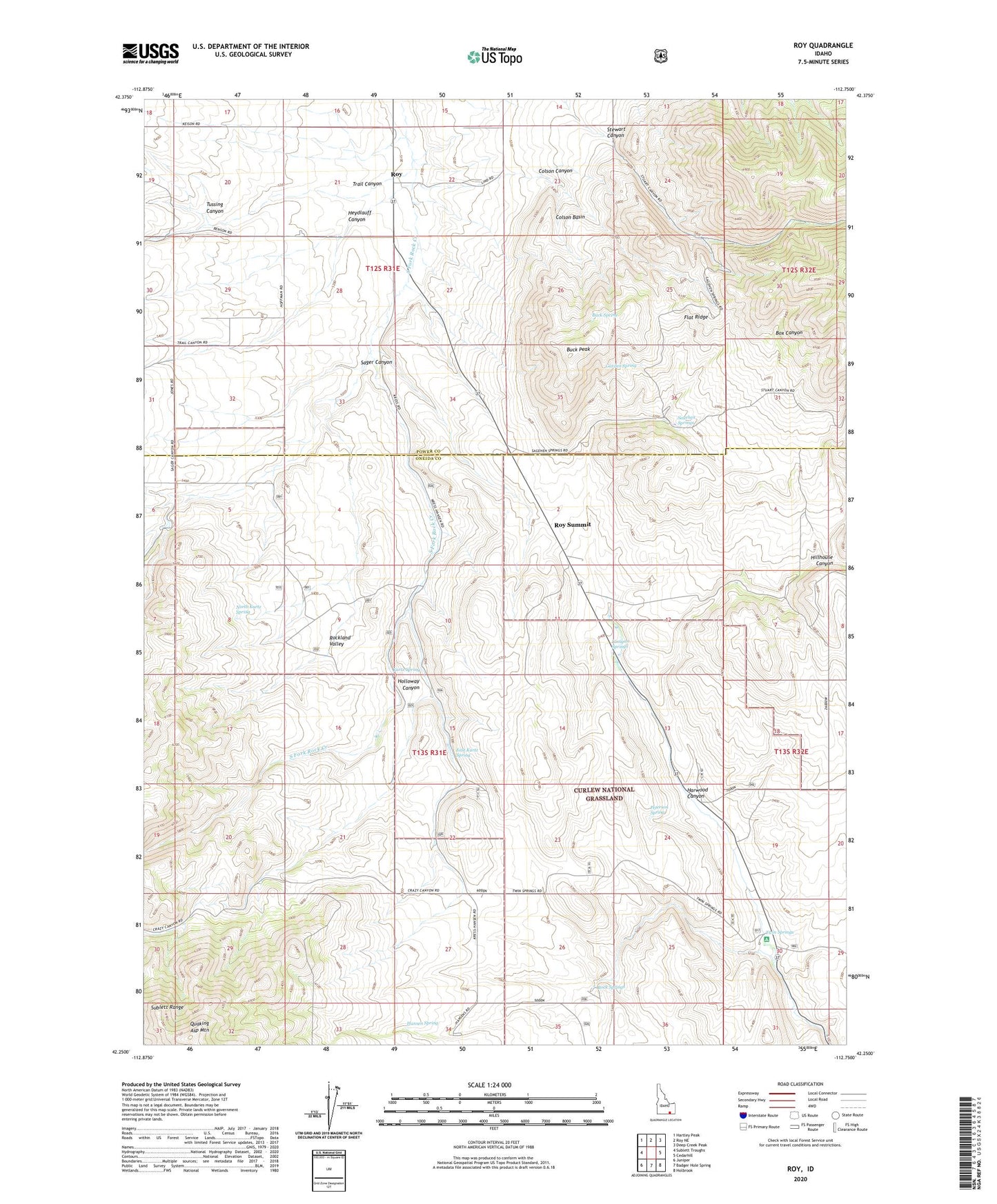
Roy Idaho US Topo Map
Couldn't load pickup availability
Also explore the Roy Forest Service Topo of this same quad for updated USFS data
2023 topographic map quadrangle Roy in the state of Idaho. Scale: 1:24000. Based on the newly updated USGS 7.5' US Topo map series, this map is in the following counties: Oneida, Power. The map contains contour data, water features, and other items you are used to seeing on USGS maps, but also has updated roads and other features. This is the next generation of topographic maps. Printed on high-quality waterproof paper with UV fade-resistant inks.
Quads adjacent to this one:
West: Sublett Troughs
Northwest: Hartley Peak
North: Roy NE
Northeast: Deep Creek Peak
East: Cedarhill
Southeast: Holbrook
South: Badger Hole Spring
Southwest: Juniper
This map covers the same area as the classic USGS quad with code o42112c7.
Contains the following named places: Box Canyon, Buck Peak, Buck Spring, Colson Basin, Colson Canyon, East Kurtz Spring, Flat Ridge, Garden Spring, Hansen Ranch, Hansen Spring, Harwood Canyon, Heydlauff Canyon, Hillhouse Canyon, Holloway Canyon, Hudspeth Cutoff Historical Marker, Kurtz Spring, Lonigan Springs, North Kurtz Spring, Peterson Spring, Quaking Asp Mountain, Rock Springs, Roy, Roy Summit, Sagehen Springs, Sager Canyon, Stewart Canyon, Trail Canyon, Tussing Canyon, Twin Springs