
MyTopo
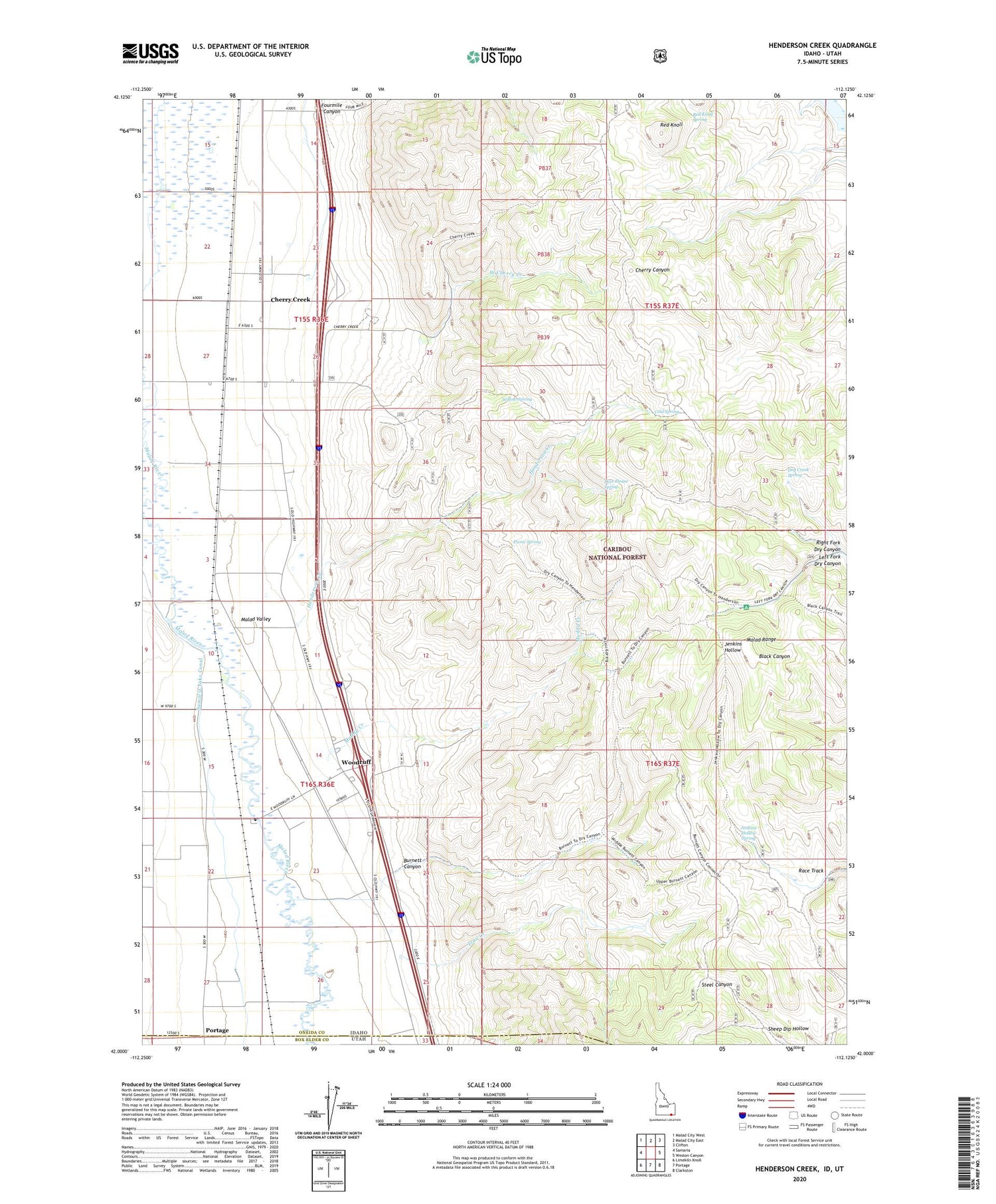
Henderson Creek Idaho US Topo Map
Couldn't load pickup availability
Also explore the Henderson Creek Forest Service Topo of this same quad for updated USFS data
2023 topographic map quadrangle Henderson Creek in the state of Idaho. Scale: 1:24000. Based on the newly updated USGS 7.5' US Topo map series, this map is in the following counties: Oneida, Box Elder. The map contains contour data, water features, and other items you are used to seeing on USGS maps, but also has updated roads and other features. This is the next generation of topographic maps. Printed on high-quality waterproof paper with UV fade-resistant inks.
Quads adjacent to this one:
West: Samaria
Northwest: Malad City West
North: Malad City East
Northeast: Clifton
East: Weston Canyon
Southeast: Clarkston
South: Portage
Southwest: Limekiln Knoll
Contains the following named places: Burnett Canyon, Cherry Creek, Cold Spring, Deer House Spring, Dry Creek Campground, Dry Creek Spring, Fourmile Canyon, Henderson Creek, Jenkins Hollow Spring, Left Fork Dry Canyon, Muddy Creek, Picnic Spring, Race Track, Red Knoll, Red Knoll Spring, Right Fork Dry Canyon, Sheep Dip Hollow, Trail Creek, West Cherry Creek, Willow Spring, Woodruff


